MyTopo
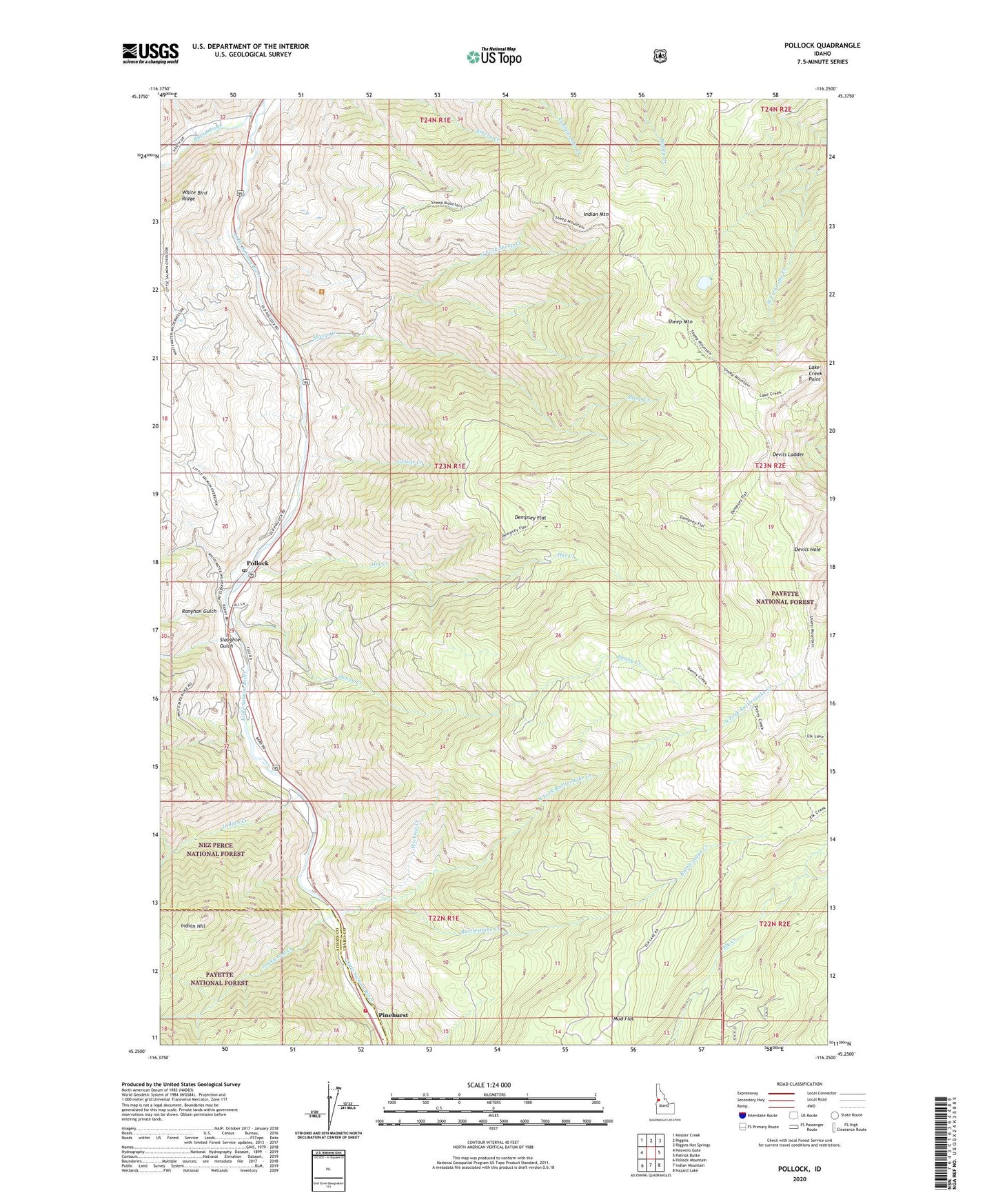
Pollock Idaho US Topo Map
Couldn't load pickup availability
Also explore the Pollock Forest Service Topo of this same quad for updated USFS data
2024 topographic map quadrangle Pollock in the state of Idaho. Scale: 1:24000. Based on the newly updated USGS 7.5' US Topo map series, this map is in the following counties: Idaho, Adams. The map contains contour data, water features, and other items you are used to seeing on USGS maps, but also has updated roads and other features. This is the next generation of topographic maps. Printed on high-quality waterproof paper with UV fade-resistant inks.
Quads adjacent to this one:
West: Heavens Gate
Northwest: Kessler Creek
North: Riggins
Northeast: Riggins Hot Springs
East: Patrick Butte
Southeast: Hazard Lake
South: Indian Mountain
Southwest: Pollock Mountain
This map covers the same area as the classic USGS quad with code o45116c3.
Contains the following named places: Carrey, Dempsey Flat, Denny Creek, Devils Hole, Devils Ladder, Gotzinger, Grouse Creek, Hat Creek, Indian Creek, Indian Hill, Indian Mountain, Lake Creek Point, Lockwood Creek, Mud Flat, North Fork Rattlesnake Creek, North Fork Sheep Creek, Pinehurst, Pollock, Pollock Post Office, Ranyhan Gulch, Rapid River, Rattlesnake Creek, Salmon River Rural Fire District Station 1, Sheep Creek, Sheep Creek Rest Area, Sheep Mountain, Slaughter Gulch, State Campground Recreation Site, Wickiup Creek