MyTopo
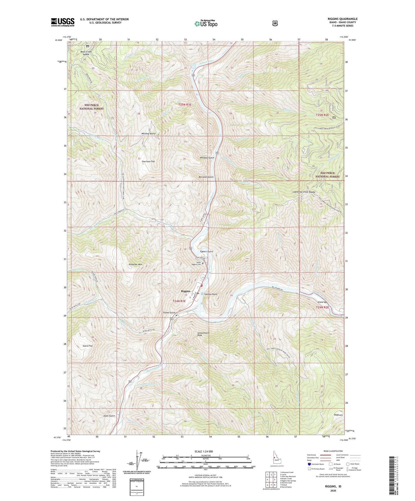
Riggins Idaho US Topo Map
Couldn't load pickup availability
Also explore the Riggins Forest Service Topo of this same quad for updated USFS data
2024 topographic map quadrangle Riggins in the state of Idaho. Scale: 1:24000. Based on the newly updated USGS 7.5' US Topo map series, this map is in the following counties: Idaho. The map contains contour data, water features, and other items you are used to seeing on USGS maps, but also has updated roads and other features. This is the next generation of topographic maps. Printed on high-quality waterproof paper with UV fade-resistant inks.
Quads adjacent to this one:
West: Kessler Creek
Northwest: Kirkwood Creek
North: Lucile
Northeast: John Day Mountain
East: Riggins Hot Springs
Southeast: Patrick Butte
South: Pollock
Southwest: Heavens Gate
This map covers the same area as the classic USGS quad with code o45116d3.
Contains the following named places: Aitken, Alum Gulch, Bean Creek, Bean Creek Saddle, Berg Creek, Captain John Creek, Chair Creek, Cherry Creek, Circle C Ranch, City of Riggins, Clarks Creek, Dogtown, Dugout Creek, Egbert Gulch, Emery Creek, Fiddle Creek, Fiddle Creek Rapids, Flume Gulch, Garrison Flat, Goat Creek, Hailey Creek, Hells Canyon Forest Service Station, Idaho State Emergency Airstrip, Island Bar, Ladder Creek, Lightning Creek, Lightning Creek Saddle, Little Berg Creek, Little Salmon River, McCanen Gulch, North Riggens, North Riggins Cemetery, Papoose Creek, Preacher Mountain, Race Creek, Riggins, Riggins City Fire Department, Riggins Elementary School, Riggins Flight Strip, Riggins Police Department, Riggins Post Office, Salmon Point, Salmon River Junior - Senior High School, Schoolmarm Peak, Shorts Creek, Soard Flat, South Fork Race Creek, Squaw Creek, Traps Creek, Walters, West Fork Race Creek, Whiskey Butte, Whiskey Gulch, Wicks, Wisdom