MyTopo
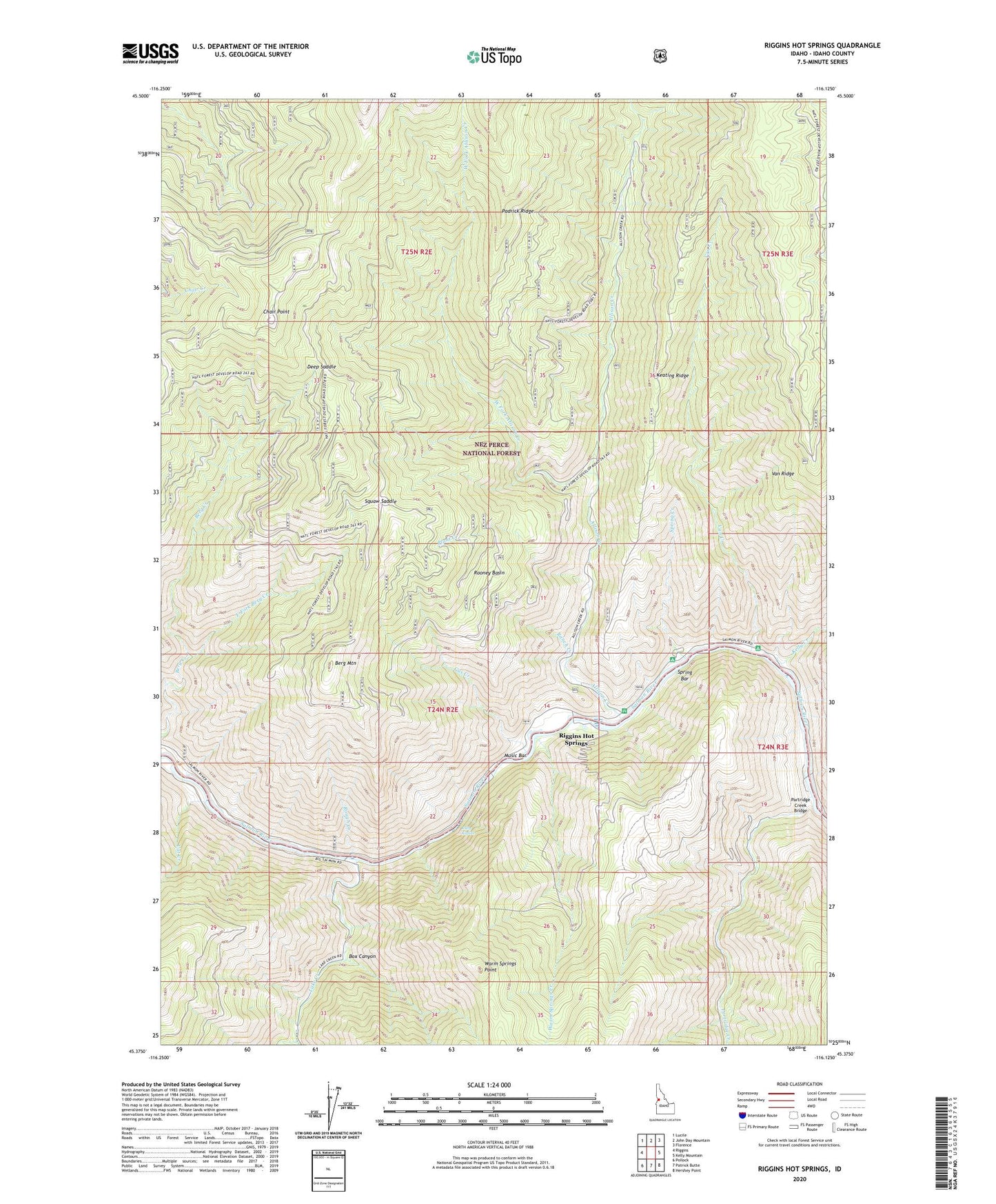
Riggins Hot Springs Idaho US Topo Map
Couldn't load pickup availability
Also explore the Riggins Hot Springs Forest Service Topo of this same quad for updated USFS data
2024 topographic map quadrangle Riggins Hot Springs in the state of Idaho. Scale: 1:24000. Based on the newly updated USGS 7.5' US Topo map series, this map is in the following counties: Idaho. The map contains contour data, water features, and other items you are used to seeing on USGS maps, but also has updated roads and other features. This is the next generation of topographic maps. Printed on high-quality waterproof paper with UV fade-resistant inks.
Quads adjacent to this one:
West: Riggins
Northwest: Lucile
North: John Day Mountain
Northeast: Florence
East: Kelly Mountain
Southeast: Hershey Point
South: Patrick Butte
Southwest: Pollock
This map covers the same area as the classic USGS quad with code o45116d2.
Contains the following named places: Allison Creek, Allison Creek Campground, Allison Creek Picnic Area, Berg Mountain, Box Canyon, Carlson, Cat Creek, Chair Point, Crum, Deep Saddle, East Fork Berg Creek, Gus Creek, Hinkley Cabin, Keating Ridge, Kelly Creek, Kiepe Place, Lake Creek, Long Cabin, Music Bar, Padrick Ridge, Partridge Creek, Partridge Creek Bridge, Plant Creek, Ranch Creek, Riggins Hot Springs, Rooney Basin, Rough Creek, Ruby Rapids, Spring Bar, Spring Bar Campground, Spring Creek, Squaw Saddle, Van Creek, Van Creek Campground, Van Ridge, Warm Springs Creek, Warm Springs Point, West Fork Allison Creek, West Fork Lake Creek