MyTopo
Dingle Idaho US Topo Map
Couldn't load pickup availability
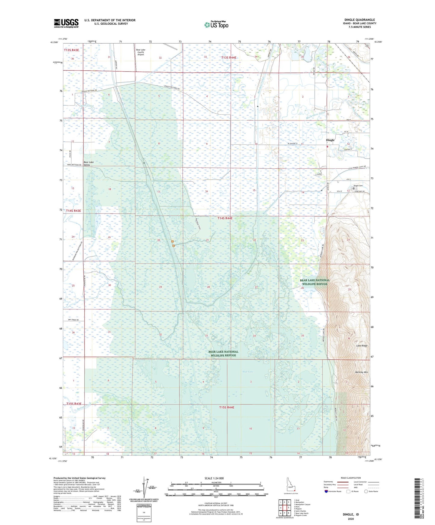
2023 topographic map quadrangle Dingle in the state of Idaho. Scale: 1:24000. Based on the newly updated USGS 7.5' US Topo map series, this map is in the following counties: Bear Lake. The map contains contour data, water features, and other items you are used to seeing on USGS maps, but also has updated roads and other features. This is the next generation of topographic maps. Printed on high-quality waterproof paper with UV fade-resistant inks.
Quads adjacent to this one:
West: Paris
Northwest: Ovid
North: Montpelier
Northeast: Montpelier Canyon
East: Pegram
Southeast: Pegram Creek
South: Bear Lake North
Southwest: Saint Charles
This map covers the same area as the classic USGS quad with code o42111b3.
Contains the following named places: Bear Lake County Airport, Bear Lake National Wildlife Refuge, Bear Lake Outlet, Bear Lake Volunteer Fire Protection District Station 2, Black Otter Canal, Bloomington Creek, Dingle, Dingle Cemetery, Dingle Swamp, Kent LaRoco Canal, Lake Ridge, Merkley Lake, Merkley Mountain, Montpelier Preston Canal, Mud Lake, Paris Creek, Rainbow Canal, Ream Crockett Canal, Spring Creek