MyTopo
Rattlesnake Ridge Idaho US Topo Map
Couldn't load pickup availability
Also explore the Rattlesnake Ridge Forest Service Topo of this same quad for updated USFS data
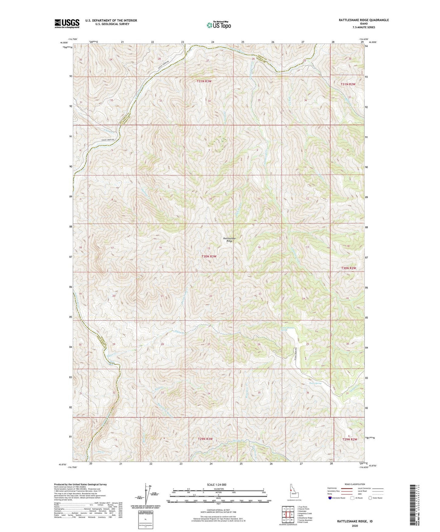
2024 topographic map quadrangle Rattlesnake Ridge in the state of Idaho. Scale: 1:24000. Based on the newly updated USGS 7.5' US Topo map series, this map is in the following counties: Idaho, Nez Perce, Lewis. The map contains contour data, water features, and other items you are used to seeing on USGS maps, but also has updated roads and other features. This is the next generation of topographic maps. Printed on high-quality waterproof paper with UV fade-resistant inks.
Quads adjacent to this one:
West: Wapshilla Creek
Northwest: Frye Point
North: Hoover Point
Northeast: Westlake
East: Boles
Southeast: Wolf Creek
South: Cactus Mountain
Southwest: Deadhorse Ridge
This map covers the same area as the classic USGS quad with code o45116h6.
Contains the following named places: Billy Creek, Camp Thomas, Camp Thomas Spring, China Creek, Cottonwood Creek, Deer Creek, Dry Creek, Eagle Creek, Flynn Creek, Flynn Creek Ranch, Fourmile Creek, Guthery Creek, Miller Creek, Pot Creek, Rattlesnake Creek, Rattlesnake Ridge, Right Fork Rock Creek, Rock Creek, Skeleton Creek, Slick Ear Creek, Thorn Spring, Wild Cow Creek