MyTopo
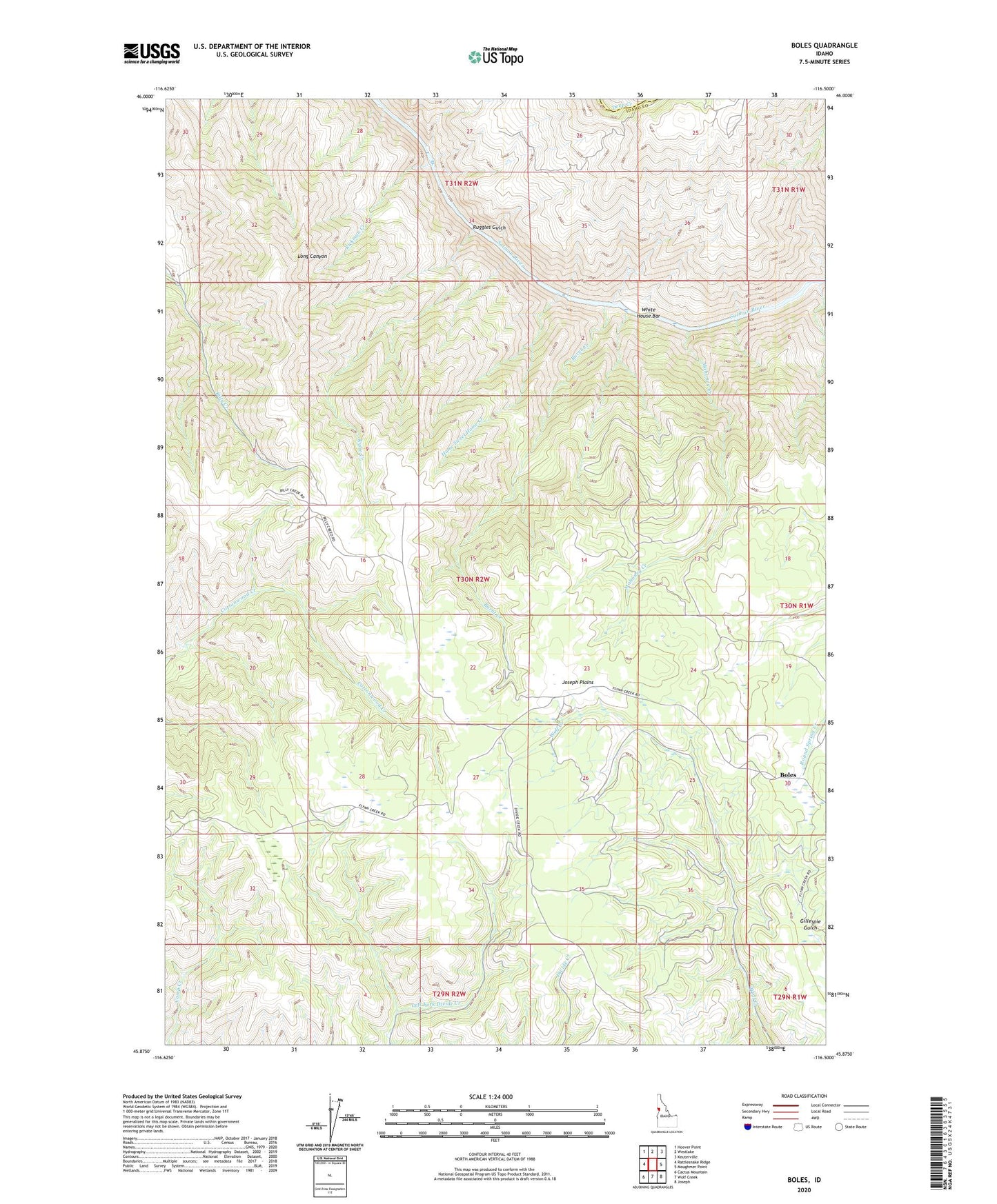
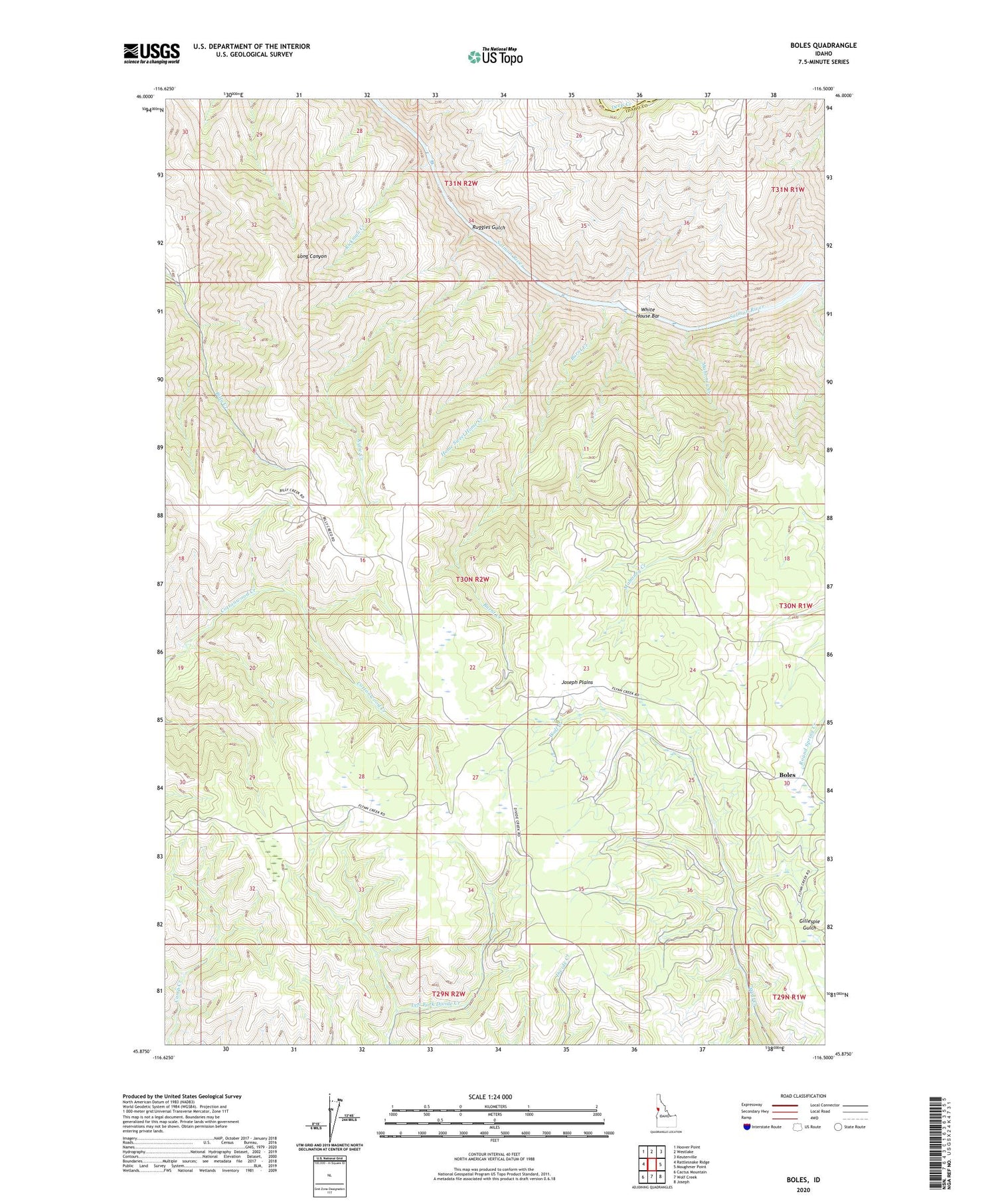
Boles Idaho US Topo Map
Couldn't load pickup availability
Also explore the Boles Forest Service Topo of this same quad for updated USFS data
2024 topographic map quadrangle Boles in the state of Idaho. Scale: 1:24000. Based on the newly updated USGS 7.5' US Topo map series, this map is in the following counties: Idaho, Lewis. The map contains contour data, water features, and other items you are used to seeing on USGS maps, but also has updated roads and other features. This is the next generation of topographic maps. Printed on high-quality waterproof paper with UV fade-resistant inks.
Quads adjacent to this one:
West: Rattlesnake Ridge
Northwest: Hoover Point
North: Westlake
Northeast: Keuterville
East: Moughmer Point
Southeast: Joseph
South: Wolf Creek
Southwest: Cactus Mountain
This map covers the same area as the classic USGS quad with code o45116h5.
Contains the following named places: Boles, Burnt Creek, Cottonwood Division, Home Sweet Home Creek, Joseph Plains, Kylie Creek, Mahoney Creek, Rickman Creek, Round Spring Creek, Ruggles Gulch, White House Bar, ZIP Code: 83522