MyTopo
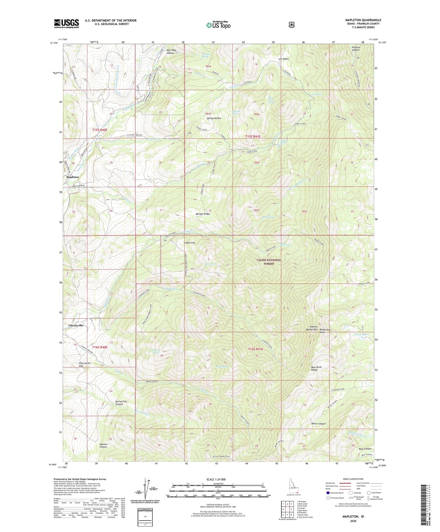
Mapleton Idaho US Topo Map
Couldn't load pickup availability
Also explore the Mapleton Forest Service Topo of this same quad for updated USFS data
2023 topographic map quadrangle Mapleton in the state of Idaho. Scale: 1:24000. Based on the newly updated USGS 7.5' US Topo map series, this map is in the following counties: Franklin. The map contains contour data, water features, and other items you are used to seeing on USGS maps, but also has updated roads and other features. This is the next generation of topographic maps. Printed on high-quality waterproof paper with UV fade-resistant inks.
Quads adjacent to this one:
West: Franklin
Northwest: Riverdale
North: Mink Creek
Northeast: Paris Peak
East: Egan Basin
Southeast: Tony Grove Creek
South: Naomi Peak
Southwest: Richmond
This map covers the same area as the classic USGS quad with code o42111a6.
Contains the following named places: Andrew Nyman Mountain, Aspen Spring, Baker Spring, Burbank Spring, Camp Wilderness, Carter Creek, Chatterton Spring, Cherryville, Cherryville Flat, Crooked Creek, Cub River Worm Creek Canal, Flat Canyon, Foster Creek, Gibson Lakes, Indian Flat, Left Fork Maple Creek, Litz Basin, Litz Creek, Litz Spring, Maple Spring, Mapleton, Morgan Ridge, Oxkiller Canyon, Paul Jones Spring, Preston Division, Sawmill Spring, Self Help Hollow, Self Help Spring, Spring Hollow, Sugar Creek, Wilderness Peak