MyTopo
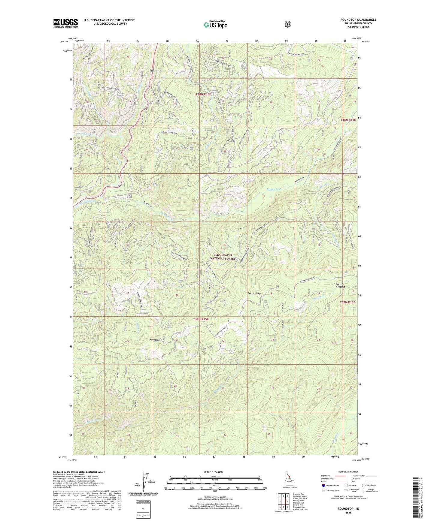
Roundtop Idaho US Topo Map
Couldn't load pickup availability
Also explore the Roundtop Forest Service Topo of this same quad for updated USFS data
2024 topographic map quadrangle Roundtop in the state of Idaho. Scale: 1:24000. Based on the newly updated USGS 7.5' US Topo map series, this map is in the following counties: Idaho. The map contains contour data, water features, and other items you are used to seeing on USGS maps, but also has updated roads and other features. This is the next generation of topographic maps. Printed on high-quality waterproof paper with UV fade-resistant inks.
Quads adjacent to this one:
West: Rocky Point
Northwest: Granite Pass
North: Lolo Hot Springs
Northeast: West Fork Butte
East: Ranger Peak
Southeast: White Sand Lake
South: Savage Ridge
Southwest: Grave Peak
This map covers the same area as the classic USGS quad with code o46114e5.
Contains the following named places: Brushy Fork, Cherokee Creek, Glade Creek Camp, Haskell Creek, Pack Creek, Rock Creek, Roundtop, Twin Creek