MyTopo
Rocky Point Idaho US Topo Map
Couldn't load pickup availability
Also explore the Rocky Point Forest Service Topo of this same quad for updated USFS data
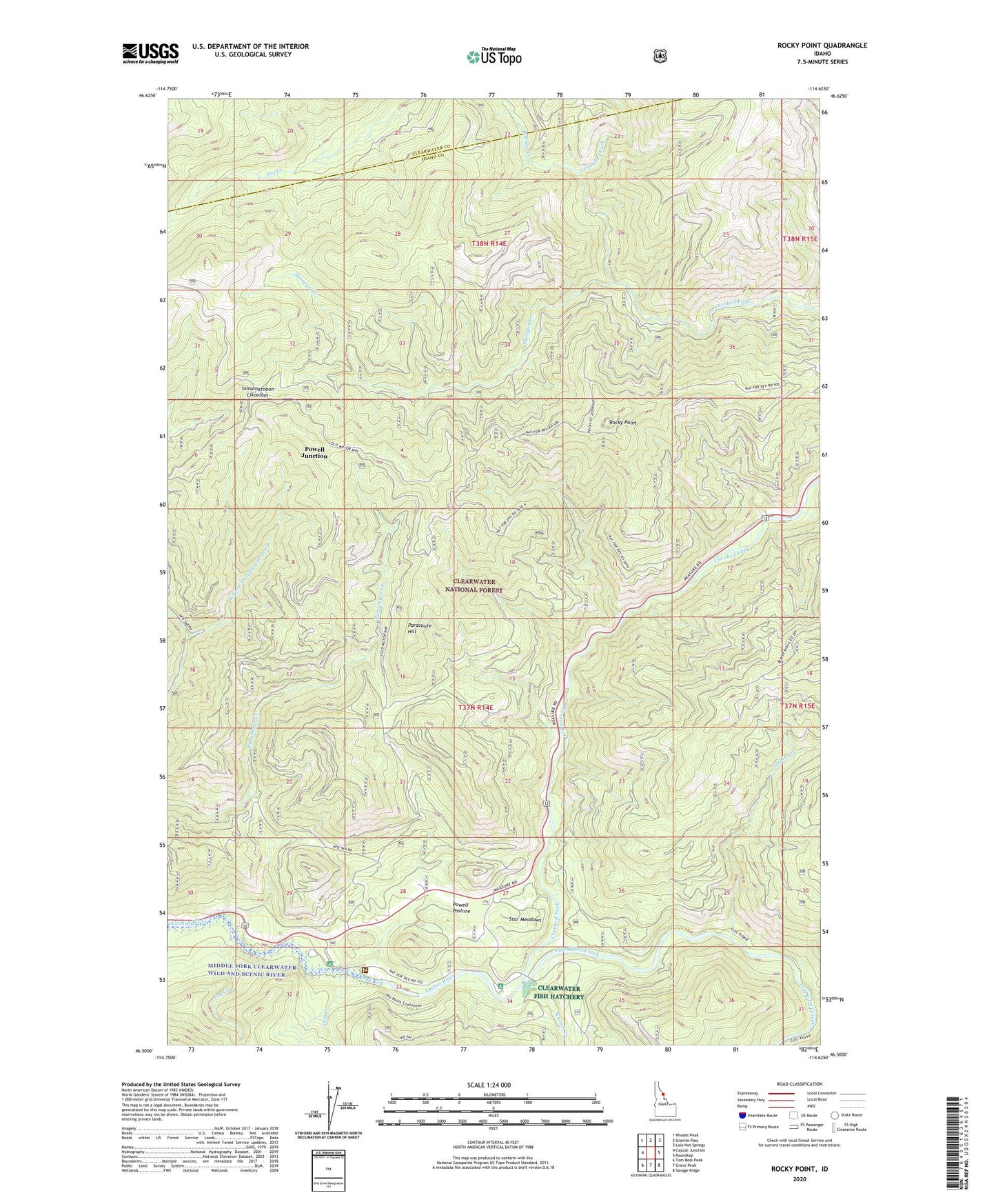
2024 topographic map quadrangle Rocky Point in the state of Idaho. Scale: 1:24000. Based on the newly updated USGS 7.5' US Topo map series, this map is in the following counties: Idaho, Clearwater. The map contains contour data, water features, and other items you are used to seeing on USGS maps, but also has updated roads and other features. This is the next generation of topographic maps. Printed on high-quality waterproof paper with UV fade-resistant inks.
Quads adjacent to this one:
West: Cayuse Junction
Northwest: Rhodes Peak
North: Granite Pass
Northeast: Lolo Hot Springs
East: Roundtop
Southeast: Savage Ridge
South: Grave Peak
Southwest: Tom Beal Peak
This map covers the same area as the classic USGS quad with code o46114e6.
Contains the following named places: Beaver Creek, Boulder Creek, Cabin Creek, Cedar Grove Picnic Area, Cliff Creek, Colt Killed Creek, Crooked Fork, 'Imnamatnoon Likoolam, Jay Creek, Lochsa Lodge, Parachute Hill, Powell Campground, Powell Elementary - Junior High School, Powell Junction, Powell Pasture, Powell Ranger Station, Rocky Point, Shotgun Creek, Star Meadows, Walton Creek, White Sand Campground