MyTopo
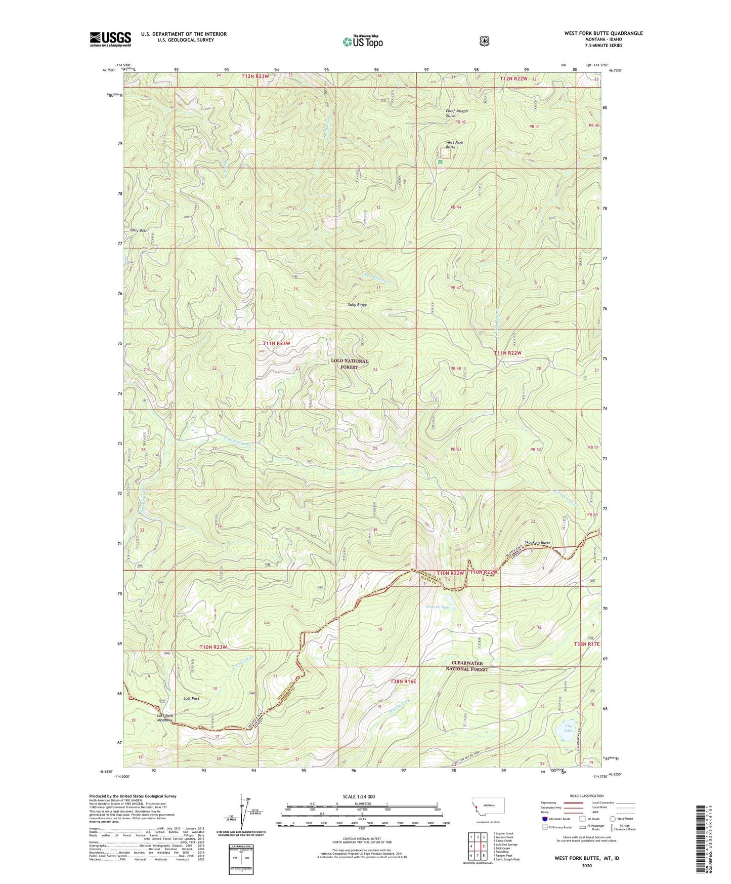
West Fork Butte Montana US Topo Map
Couldn't load pickup availability
Also explore the West Fork Butte Forest Service Topo of this same quad for updated USFS data
2024 topographic map quadrangle West Fork Butte in the states of Montana, Idaho. Scale: 1:24000. Based on the newly updated USGS 7.5' US Topo map series, this map is in the following counties: Missoula, Idaho. The map contains contour data, water features, and other items you are used to seeing on USGS maps, but also has updated roads and other features. This is the next generation of topographic maps. Printed on high-quality waterproof paper with UV fade-resistant inks.
Quads adjacent to this one:
West: Lolo Hot Springs
Northwest: Lupine Creek
North: Garden Point
Northeast: Camp Creek
East: Dick Creek
Southeast: Saint Joseph Peak
South: Ranger Peak
Southwest: Roundtop
This map covers the same area as the classic USGS quad with code o46114f4.
Contains the following named places: Granite Lake, Lily Lake, Lost Park, Lost Park Creek, Lost Park Meadows, Sally Ridge, Sally Ridge Trail, Skookum Butte, Skookum Butte Lookout, West Fork Butte, West Fork Butte Lookout, ZIP Code: 59847