MyTopo
Stouts Mountain Idaho US Topo Map
Couldn't load pickup availability
Also explore the Stouts Mountain Forest Service Topo of this same quad for updated USFS data
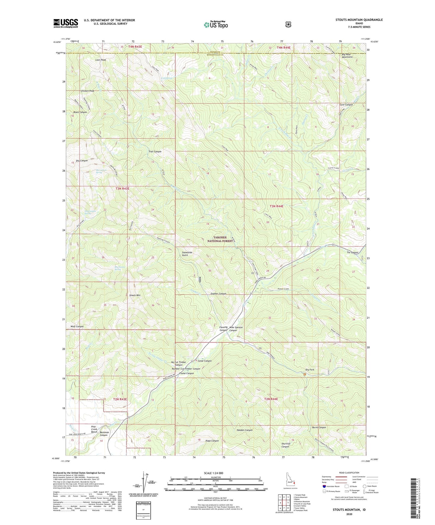
2023 topographic map quadrangle Stouts Mountain in the state of Idaho. Scale: 1:24000. Based on the newly updated USGS 7.5' US Topo map series, this map is in the following counties: Bonneville, Teton. The map contains contour data, water features, and other items you are used to seeing on USGS maps, but also has updated roads and other features. This is the next generation of topographic maps. Printed on high-quality waterproof paper with UV fade-resistant inks.
Quads adjacent to this one:
West: Wheaton Mountain
Northwest: Temple Peak
North: Garns Mountain
Northeast: Bates
East: Fourth of July Peak
Southeast: Thompson Peak
South: Swan Valley
Southwest: Conant Valley
This map covers the same area as the classic USGS quad with code o43111e3.
Contains the following named places: Beckman Canyon, Burnt Canyon, Canal Canyon, Cave Canyon, Chicken Creek, Chicken Peak, Cold Spring, Corral Creek, Dry Canyon Spring, Dry Fork, Fleming Canyon, Flume Canyon, Gopher Canyon, Gopher Creek, Holter Creek, Liars Peak, Lookingglass Creek, McCoullock Spring, Mike Spencer Canyon, No Cut Timber Canyon, No Cut Timber Creek, North Fork Pine Creek, Pine Basin Ski Area, Poison Creek, Red Creek, Roy Farnes Spring, Snowslide Gulch, Station Creek, Stouts Mountain, Tie Canyon, Trail Canyon, West Pine Creek, West Pine Creek Girls Camp, Wolf Creek