MyTopo
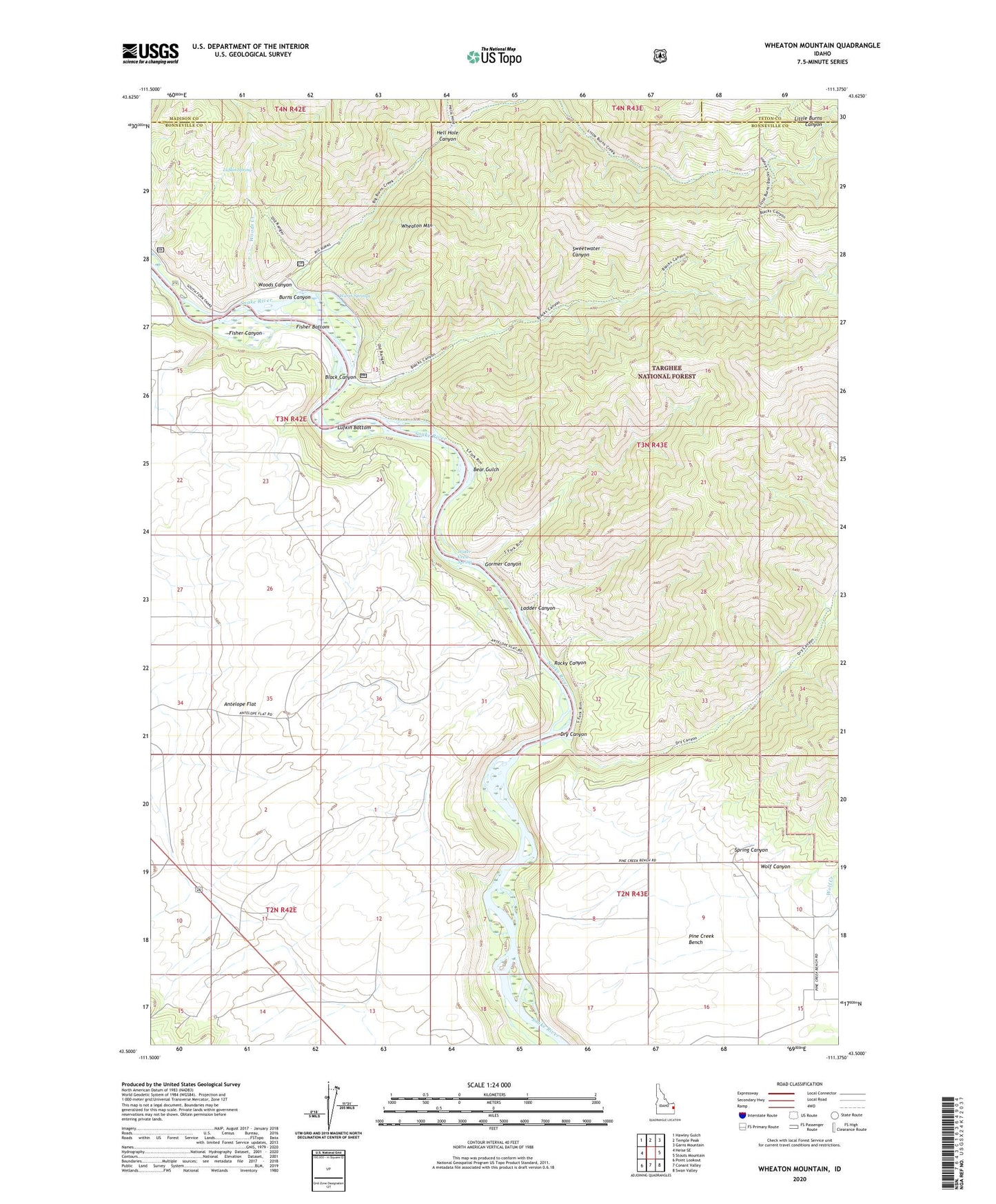
Wheaton Mountain Idaho US Topo Map
Couldn't load pickup availability
Also explore the Wheaton Mountain Forest Service Topo of this same quad for updated USFS data
2024 topographic map quadrangle Wheaton Mountain in the state of Idaho. Scale: 1:24000. Based on the newly updated USGS 7.5' US Topo map series, this map is in the following counties: Bonneville, Madison, Teton. The map contains contour data, water features, and other items you are used to seeing on USGS maps, but also has updated roads and other features. This is the next generation of topographic maps. Printed on high-quality waterproof paper with UV fade-resistant inks.
Quads adjacent to this one:
West: Heise SE
Northwest: Hawley Gulch
North: Temple Peak
Northeast: Garns Mountain
East: Stouts Mountain
Southeast: Swan Valley
South: Conant Valley
Southwest: Point Lookout
This map covers the same area as the classic USGS quad with code o43111e4.
Contains the following named places: Bear Gulch, Black Canyon, Burns Canyon, Diamond X Canyon, Dry Canyon, Fisher Bottom, Fisher Canyon, Gormer Canyon, Hell Hole Canyon, Jensen Creek, Ladder Canyon, Lufkin Bottom, Lufkin Spring, Rocky Canyon, Spring Canyon, Warm Springs, Water Crest Spring, Wheaton Mountain, Wolf Canyon, Woods Canyon, Woods Creek