MyTopo
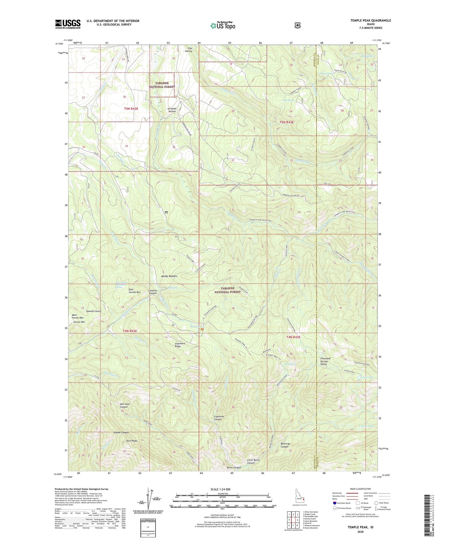
Temple Peak Idaho US Topo Map
Couldn't load pickup availability
Also explore the Temple Peak Forest Service Topo of this same quad for updated USFS data
2024 topographic map quadrangle Temple Peak in the state of Idaho. Scale: 1:24000. Based on the newly updated USGS 7.5' US Topo map series, this map is in the following counties: Madison, Teton. The map contains contour data, water features, and other items you are used to seeing on USGS maps, but also has updated roads and other features. This is the next generation of topographic maps. Printed on high-quality waterproof paper with UV fade-resistant inks.
Quads adjacent to this one:
West: Hawley Gulch
Northwest: White Owl Butte
North: Wright Creek
Northeast: Packsaddle Lake
East: Garns Mountain
Southeast: Stouts Mountain
South: Wheaton Mountain
Southwest: Heise SE
This map covers the same area as the classic USGS quad with code o43111f4.
Contains the following named places: Argument Ridge, Beartrap Canyon, Bex Spring, Buck Spring, Carlton Cutoff Trail, Castle Lake, Coalmine Canyon, Coalmine Creek, Coyote Canyon, Crystal Lake, East Farnes Mountain, East Farnes Mountain Spring, Farnes Mountain, Flat Hollow, Graham Spring, Hilton Creek, Kirkham Hollow, Little Burns Canyon, Lost Spring, Marlow Creek, Moody Meadow, Moody Swamp, North Fork Canyon Creek, Prospect Peak, Red Butte, Ruby Creek, Sheep Creek, South Fork Canyon Creek, Sweetwater Canyon, Temple Peak, Thousand Springs Valley, Twin Peaks, West Farnes Mountain