MyTopo
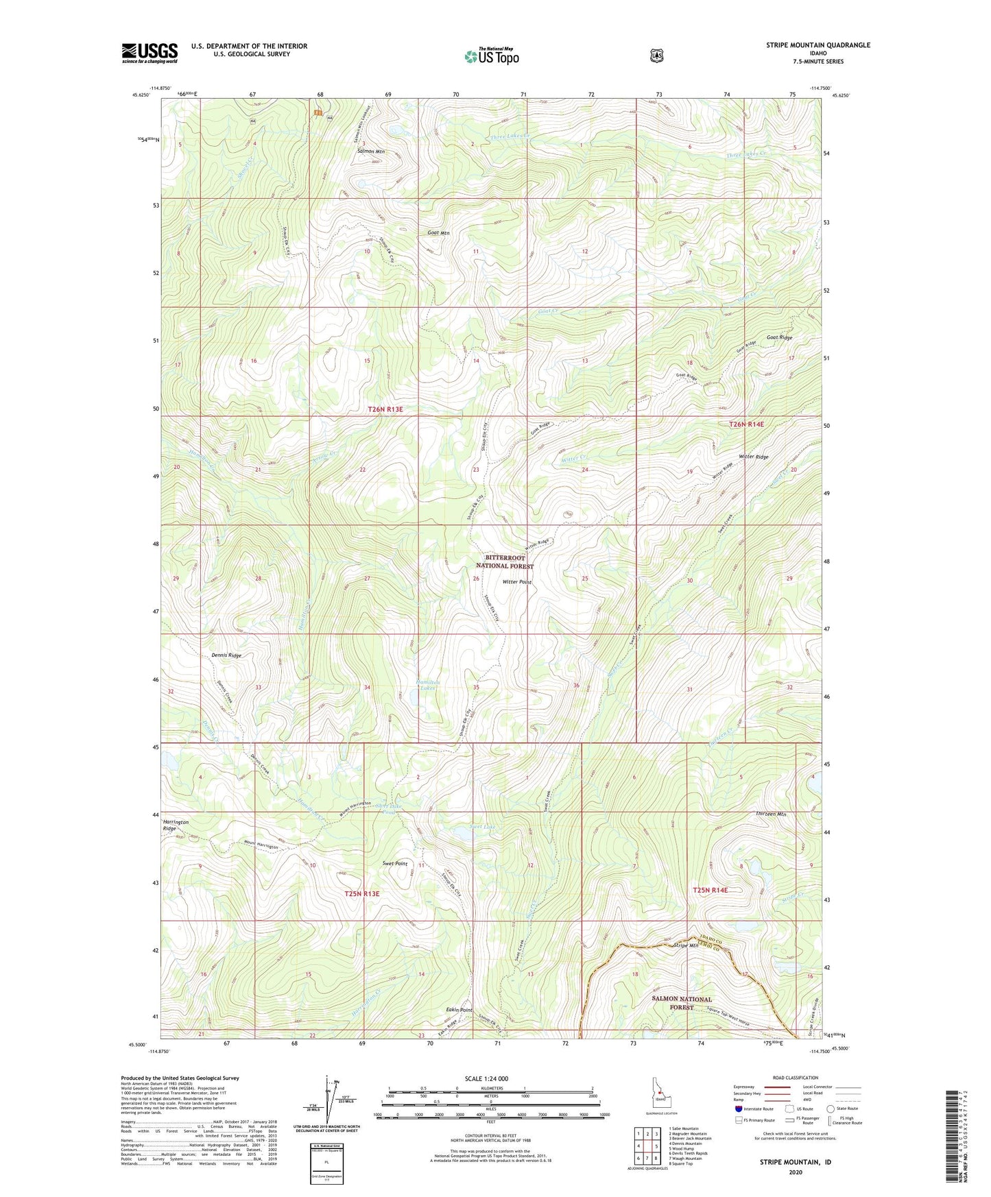
Stripe Mountain Idaho US Topo Map
Couldn't load pickup availability
Also explore the Stripe Mountain Forest Service Topo of this same quad for updated USFS data
2024 topographic map quadrangle Stripe Mountain in the state of Idaho. Scale: 1:24000. Based on the newly updated USGS 7.5' US Topo map series, this map is in the following counties: Idaho, Lemhi. The map contains contour data, water features, and other items you are used to seeing on USGS maps, but also has updated roads and other features. This is the next generation of topographic maps. Printed on high-quality waterproof paper with UV fade-resistant inks.
Quads adjacent to this one:
West: Dennis Mountain
Northwest: Sabe Mountain
North: Magruder Mountain
Northeast: Beaver Jack Mountain
East: Wood Hump
Southeast: Square Top
South: Waugh Mountain
Southwest: Devils Teeth Rapids
This map covers the same area as the classic USGS quad with code o45114e7.
Contains the following named places: Arrow Campsite, Arrow Creek, Base Camp Campground, Devils Washbasin, Eakin Point, Goat Mountain, Goat Ridge, Hamilton Lakes, Harrington Ridge, Salmon Mountain, Stripe Mountain, Swet Lake, Swet Lake Cabin, Swet Lake Pond, Swet Point, Thirteen Lakes, Thirteen Mountain, Witter Point, Witter Ridge, Witter Ridge Campsite