MyTopo
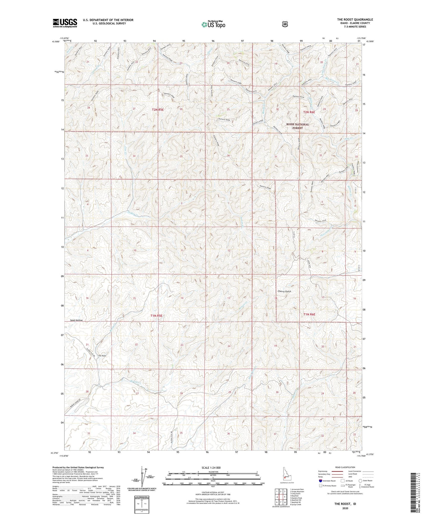
The Roost Idaho US Topo Map
Couldn't load pickup availability
Also explore the The Roost Forest Service Topo of this same quad for updated USFS data
2023 topographic map quadrangle The Roost in the state of Idaho. Scale: 1:24000. Based on the newly updated USGS 7.5' US Topo map series, this map is in the following counties: Elmore. The map contains contour data, water features, and other items you are used to seeing on USGS maps, but also has updated roads and other features. This is the next generation of topographic maps. Printed on high-quality waterproof paper with UV fade-resistant inks.
Quads adjacent to this one:
West: Mayfield
Northwest: Arrowrock Dam
North: Grape Mountain
Northeast: Long Gulch
East: Danskin Peak
Southeast: Syrup Creek
South: Mayfield SE
Southwest: Mayfield SW
This map covers the same area as the classic USGS quad with code o43115d7.
Contains the following named places: Beaver Creek, Big Horse Creek, Cottonwood Creek, Cow Creek, Fornham Creek, Little Horse Creek, Pine Creek, Porcupine Creek, Roost Creek, The Roost, Thomson Ranch