MyTopo
Danskin Peak Idaho US Topo Map
Couldn't load pickup availability
Also explore the Danskin Peak Forest Service Topo of this same quad for updated USFS data
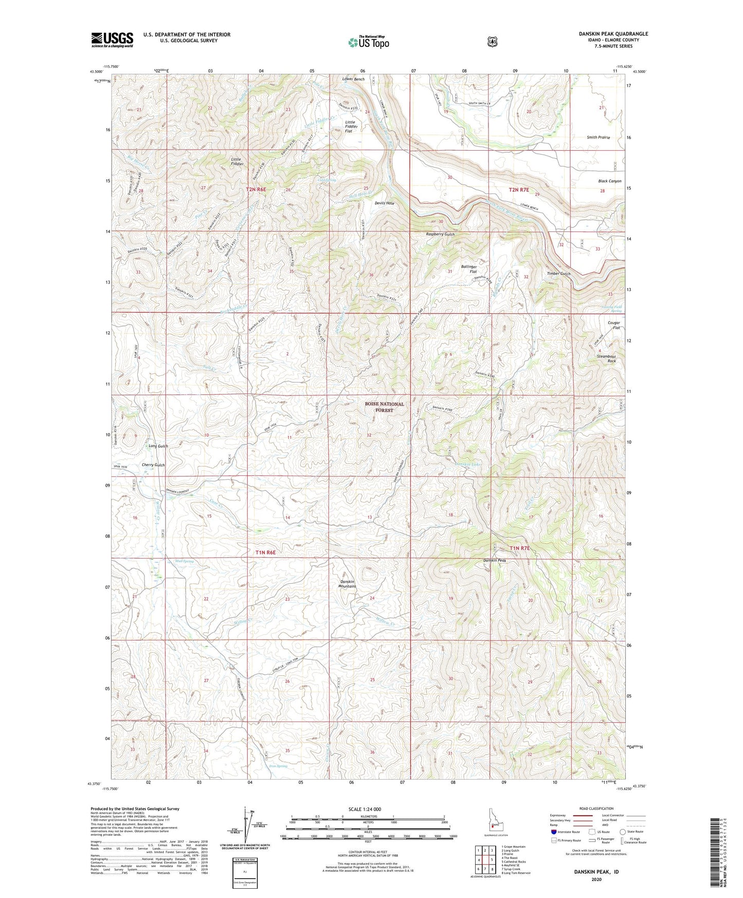
2023 topographic map quadrangle Danskin Peak in the state of Idaho. Scale: 1:24000. Based on the newly updated USGS 7.5' US Topo map series, this map is in the following counties: Elmore. The map contains contour data, water features, and other items you are used to seeing on USGS maps, but also has updated roads and other features. This is the next generation of topographic maps. Printed on high-quality waterproof paper with UV fade-resistant inks.
Quads adjacent to this one:
West: The Roost
Northwest: Grape Mountain
North: Long Gulch
Northeast: Prairie
East: Cathedral Rocks
Southeast: Long Tom Reservoir
South: Syrup Creek
Southwest: Mayfield SE
This map covers the same area as the classic USGS quad with code o43115d6.
Contains the following named places: Ballinger Flat, Black Canyon, Bounds Creek, Case Creek, Cherry Gulch, Cold Spring, Cougar Flat, Danskin Lake, Danskin Mountains, Danskin Peak, Devils Hole, Devils Hole Creek, Hell Hole Creek, Iron Spring, Little Fiddler, Little Fiddler Creek, Little Fiddler Flat, Long Gulch, Mud Spring, Packsaddle Creek, Pole Creek, Raspberry Gulch, Salt Creek, Steamboat Rock, Timber Gulch, Willow Creek Guard Station