
MyTopo
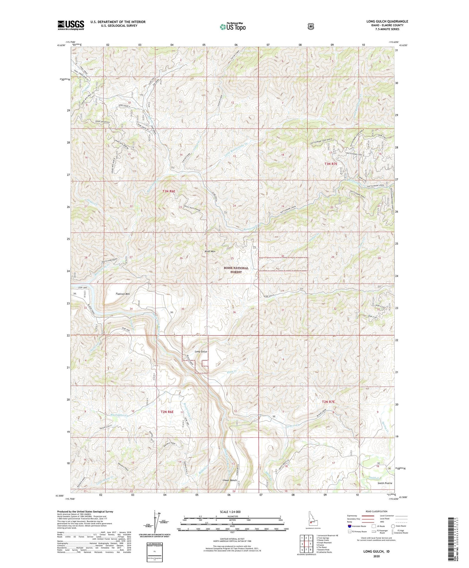
Long Gulch Idaho US Topo Map
Couldn't load pickup availability
Also explore the Long Gulch Forest Service Topo of this same quad for updated USFS data
2023 topographic map quadrangle Long Gulch in the state of Idaho. Scale: 1:24000. Based on the newly updated USGS 7.5' US Topo map series, this map is in the following counties: Elmore. The map contains contour data, water features, and other items you are used to seeing on USGS maps, but also has updated roads and other features. This is the next generation of topographic maps. Printed on high-quality waterproof paper with UV fade-resistant inks.
Quads adjacent to this one:
West: Grape Mountain
Northwest: Arrowrock Reservoir NE
North: Twin Springs
Northeast: Sheep Creek
East: Prairie
Southeast: Cathedral Rocks
South: Danskin Peak
Southwest: The Roost
This map covers the same area as the classic USGS quad with code o43115e6.
Contains the following named places: Big Fiddler Creek, Boise River Wildlife Management Area, Buffalo Creek, Chicken Creek, Corral Creek, Crank Creek, Elk Creek, Elk Creek Exclosure, Flatiron Mountain, Grape Creek, Graves Creek, Jackass Creek, Krall Mountain, Little Rattlesnake Creek, Long Gulch, Long Gulch Guard Station, Lower Bench, Pony Creek, Rattlesnake Campground, Rattlesnake Creek, Smith Creek, Spring Creek, Timber Creek, Wood Cabin Creek


