MyTopo
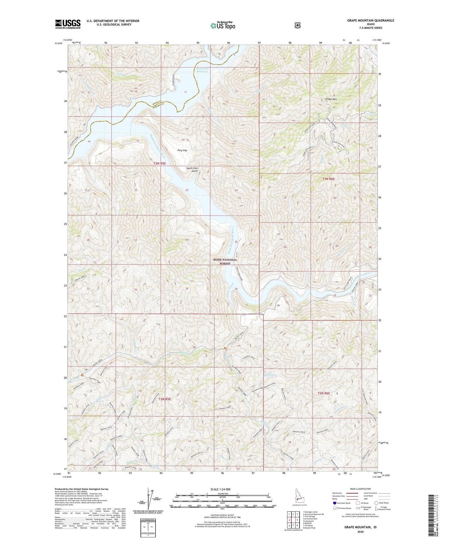
Grape Mountain Idaho US Topo Map
Couldn't load pickup availability
Also explore the Grape Mountain Forest Service Topo of this same quad for updated USFS data
2024 topographic map quadrangle Grape Mountain in the state of Idaho. Scale: 1:24000. Based on the newly updated USGS 7.5' US Topo map series, this map is in the following counties: Elmore, Boise. The map contains contour data, water features, and other items you are used to seeing on USGS maps, but also has updated roads and other features. This is the next generation of topographic maps. Printed on high-quality waterproof paper with UV fade-resistant inks.
Quads adjacent to this one:
West: Arrowrock Dam
Northwest: Dunnigan Creek
North: Arrowrock Reservoir NE
Northeast: Twin Springs
East: Long Gulch
Southeast: Danskin Peak
South: The Roost
Southwest: Mayfield
This map covers the same area as the classic USGS quad with code o43115e7.
Contains the following named places: Arrowrock Reservoir, Bender Creek, Camp Creek, Cold Spring Creek, Corral Creek, Cottonwood Creek, Cow Creek, Dawes Creek, Deadman Creek, Flat Creek, Grape Mountain, Hutton Creek, Irish Creek, Jack Creek, Lambing Creek, Lime Creek, Nevins Creek, Nibbler Creek, Pury Flat, Soap Creek, South Fork Boise River, South Fork Gulch, Willow Creek, Wood Creek