MyTopo
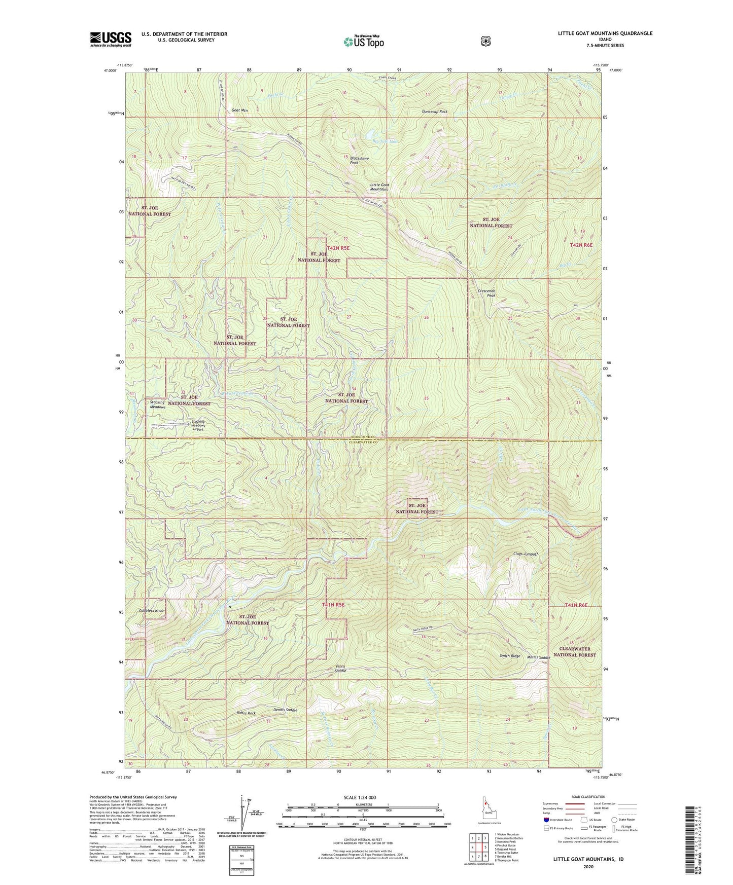
Little Goat Mountains Idaho US Topo Map
Couldn't load pickup availability
Also explore the Little Goat Mountains Forest Service Topo of this same quad for updated USFS data
2024 topographic map quadrangle Little Goat Mountains in the state of Idaho. Scale: 1:24000. Based on the newly updated USGS 7.5' US Topo map series, this map is in the following counties: Shoshone, Clearwater. The map contains contour data, water features, and other items you are used to seeing on USGS maps, but also has updated roads and other features. This is the next generation of topographic maps. Printed on high-quality waterproof paper with UV fade-resistant inks.
Quads adjacent to this one:
West: Pinchot Butte
Northwest: Widow Mountain
North: Monumental Buttes
Northeast: Montana Peak
East: Buzzard Roost
Southeast: Thompson Point
South: Bertha Hill
Southwest: Township Butte
This map covers the same area as the classic USGS quad with code o46115h7.
Contains the following named places: Big Talk Lake, Blackdome Peak, Blue Heaven Cabin, Bohns Rock, Cedar Creek, Clugs Jumpoff, Cobblers Knob, Crescendo Peak, Dennis Saddle, Duncecap Rock, East Fork Cedar Creek, Fells Creek, Finns Cabin, Finns Saddle, Goat Mountain, Little Goat Mountains, Morris Saddle, Stocking Meadows, Stocking Meadows Airport, Tangle Creek, West Fork Cedar Creek