MyTopo
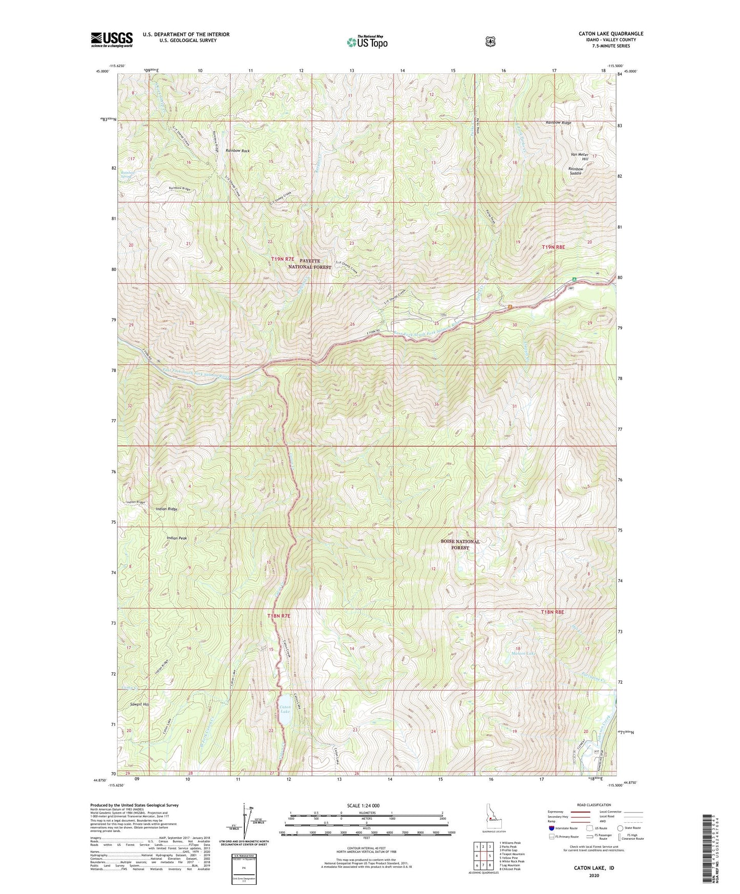
Caton Lake Idaho US Topo Map
Couldn't load pickup availability
Also explore the Caton Lake Forest Service Topo of this same quad for updated USFS data
2024 topographic map quadrangle Caton Lake in the state of Idaho. Scale: 1:24000. Based on the newly updated USGS 7.5' US Topo map series, this map is in the following counties: Valley. The map contains contour data, water features, and other items you are used to seeing on USGS maps, but also has updated roads and other features. This is the next generation of topographic maps. Printed on high-quality waterproof paper with UV fade-resistant inks.
Quads adjacent to this one:
West: Teapot Mountain
Northwest: Williams Peak
North: Parks Peak
Northeast: Profile Gap
East: Yellow Pine
Southeast: Chilcoot Peak
South: Log Mountain
Southwest: White Rock Peak
This map covers the same area as the classic USGS quad with code o44115h5.
Contains the following named places: Caton Creek, Caton Lake, East Fork Parks Creek, Indian Peak, Indian Ridge, Johnson Creek, Loosum Creek, Marion Lake, Parks Creek, Porcupine Creek, Rainbow Rock, Rainbow Saddle, Rainbow Spring, Reegan Creek, Sawpit Hill, Van Meter Hill, West Fork Caton Creek