MyTopo
Charleston North Illinois US Topo Map
Couldn't load pickup availability
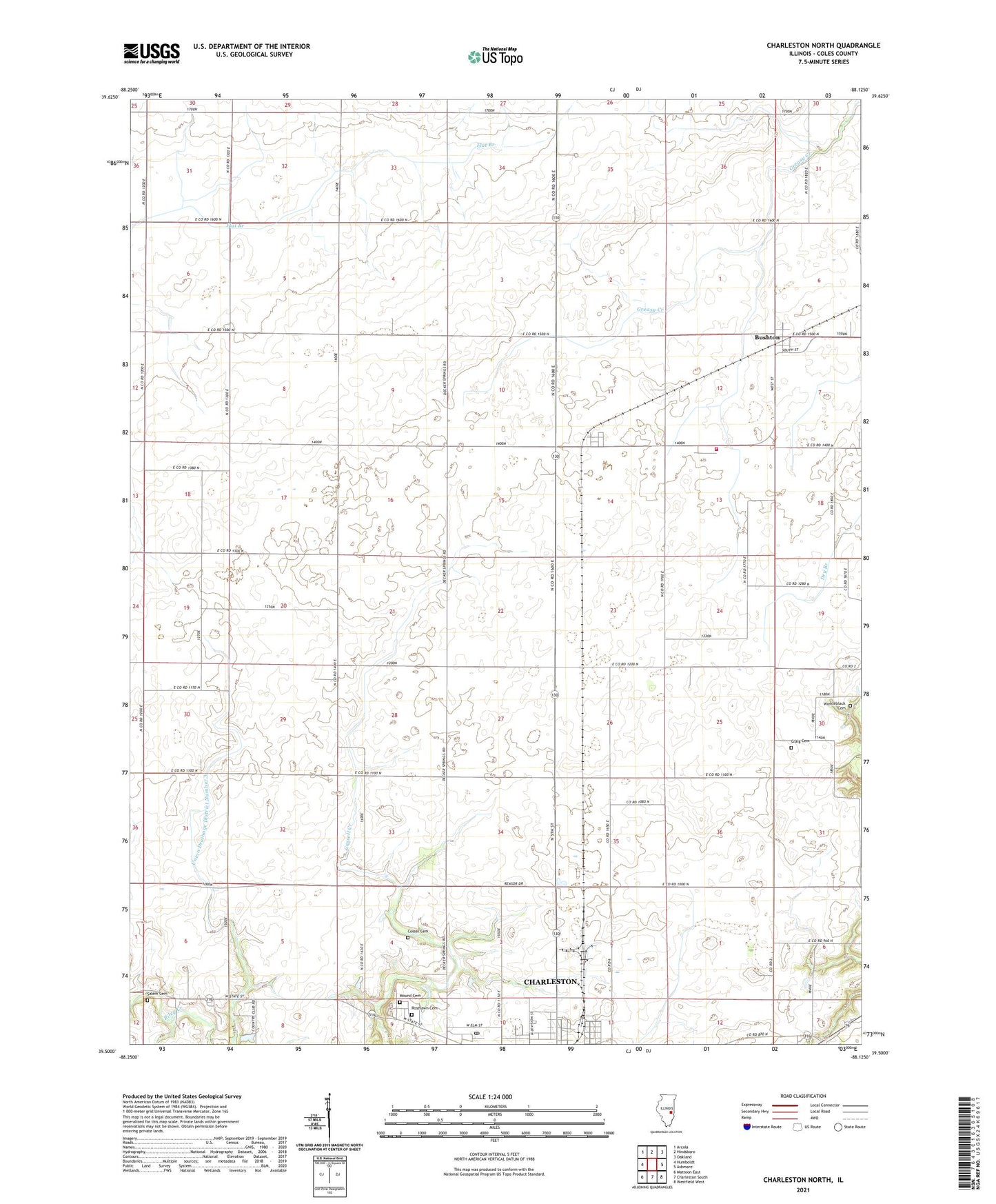
2024 topographic map quadrangle Charleston North in the state of Illinois. Scale: 1:24000. Based on the newly updated USGS 7.5' US Topo map series, this map is in the following counties: Coles. The map contains contour data, water features, and other items you are used to seeing on USGS maps, but also has updated roads and other features. This is the next generation of topographic maps. Printed on high-quality waterproof paper with UV fade-resistant inks.
Quads adjacent to this one:
West: Humboldt
Northwest: Arcola
North: Hindsboro
Northeast: Oakland
East: Ashmore
Southeast: Westfield West
South: Charleston South
Southwest: Mattoon East
This map covers the same area as the classic USGS quad with code o39088e2.
Contains the following named places: Bunker Hill School, Bushton, Bushton Post Office, Center School, Charleston Post Office, Coles County, Contrary School, Cossel Cemetery, Craig Cemetery, Dice School, Fairgrange, First Apostolic Church, Glassco School, Grant School, Marshall School, Martin Box School, Mound Cemetery, Mullen School, North Union Church, O'Hara School, Old Salem Church, Roselawn Cemetery, Salem Cemetery, Seven Hickory - Morgan Fire Protection District, Seven Hickory School, Township of Seven Hickory, Union Drainage District Number 3, Walnut Grove Church, Walnut Grove School, WEIC-AM (Charleston), WEIC-FM (Charleston), Winkleblack Cemetery, Winkleblack School, ZIP Code: 61920