MyTopo
Atwater Illinois US Topo Map
Couldn't load pickup availability
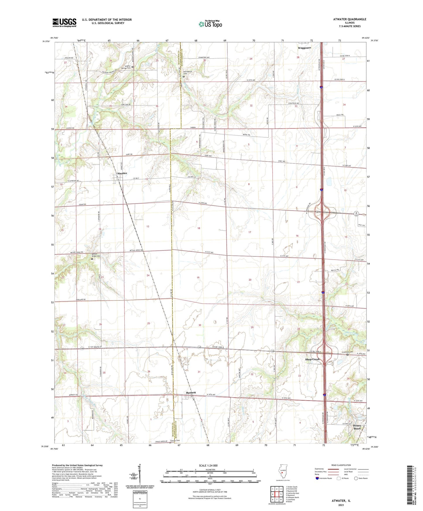
2024 topographic map quadrangle Atwater in the state of Illinois. Scale: 1:24000. Based on the newly updated USGS 7.5' US Topo map series, this map is in the following counties: Montgomery, Macoupin. The map contains contour data, water features, and other items you are used to seeing on USGS maps, but also has updated roads and other features. This is the next generation of topographic maps. Printed on high-quality waterproof paper with UV fade-resistant inks.
Quads adjacent to this one:
West: Carlinville East
Northwest: Virden South
North: Farmersville
Northeast: Raymond NE
East: Raymond
Southeast: Butler
South: Litchfield
Southwest: Gillespie North
This map covers the same area as the classic USGS quad with code o39089c6.
Contains the following named places: Atwater, Atwater Post Office, Barnett, Bethel Church, Bethel Ridge Cemetery, Carrico Cemetery, Crawford Cemetery, Deer Branch, Emery Landing Strip, Fairview School, Horse Creek, Lake Fork School, New Hope Church, Pleasant Hill Church, Pleasant Hill School, Pleasant Prairie School, Providence Cemetery, Providence Church, Shaw Point School, Shearles Branch, Shiloh School, Shop Creek, Sulphur Springs Cemetery, Sulphur Springs Church, Township of Zanesville, Vignos School, Zanesville, Zanesville School, Zanesville Townhall, ZIP Code: 62572