MyTopo
Farmersville Illinois US Topo Map
Couldn't load pickup availability
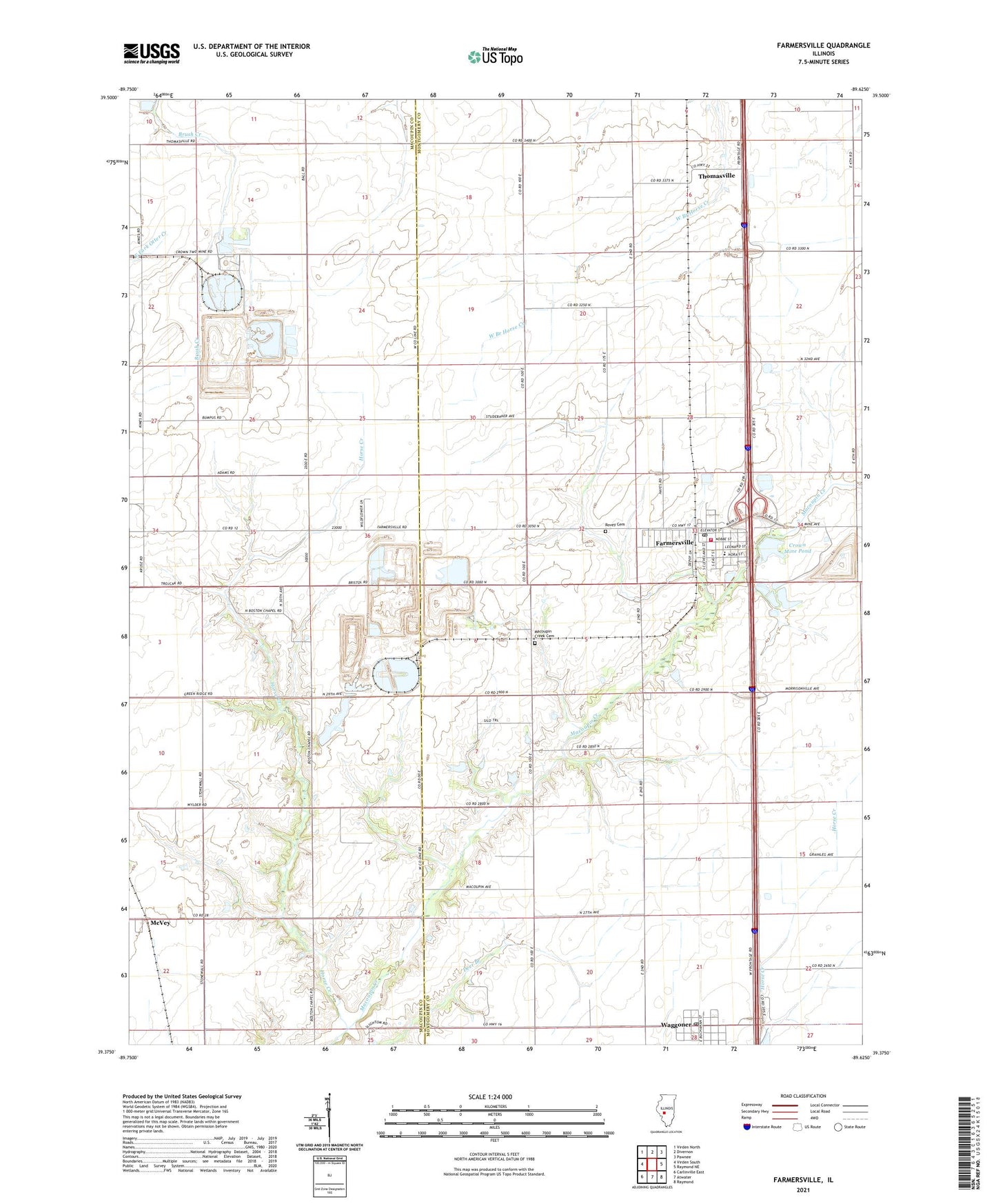
2024 topographic map quadrangle Farmersville in the state of Illinois. Scale: 1:24000. Based on the newly updated USGS 7.5' US Topo map series, this map is in the following counties: Montgomery, Macoupin. The map contains contour data, water features, and other items you are used to seeing on USGS maps, but also has updated roads and other features. This is the next generation of topographic maps. Printed on high-quality waterproof paper with UV fade-resistant inks.
Quads adjacent to this one:
West: Virden South
Northwest: Virden North
North: Divernon
Northeast: Pawnee
East: Raymond NE
Southeast: Raymond
South: Atwater
Southwest: Carlinville East
This map covers the same area as the classic USGS quad with code o39089d6.
Contains the following named places: Ball School, Bartlett School, Boston Chapel Christian Church, Boston Chapel School, Crown Mine Number 1, Crown Mine Number 2, Crown Mine Pond, Crown Mine Pond Dam, East Union School, Farmersville, Farmersville - Waggoner Ambulance Service, Farmersville - Waggoner Fire Department, Farmersville Elementary School, Farmersville Post Office, Horse Creek, Lake School, Lloyd Airport, Macoupin Creek Cemetery, McVey, New Hope Church, New Hope School, Prairiedale School, Rovey Cemetery, Saint Marys Catholic Church, South Bois d'Arc School, Star School, Studebaker School, Thomasville, Township of Pitman, Village of Farmersville, Village of Waggoner, Waggoner, White School, Zion Lutheran Church