MyTopo
Raymond Illinois US Topo Map
Couldn't load pickup availability
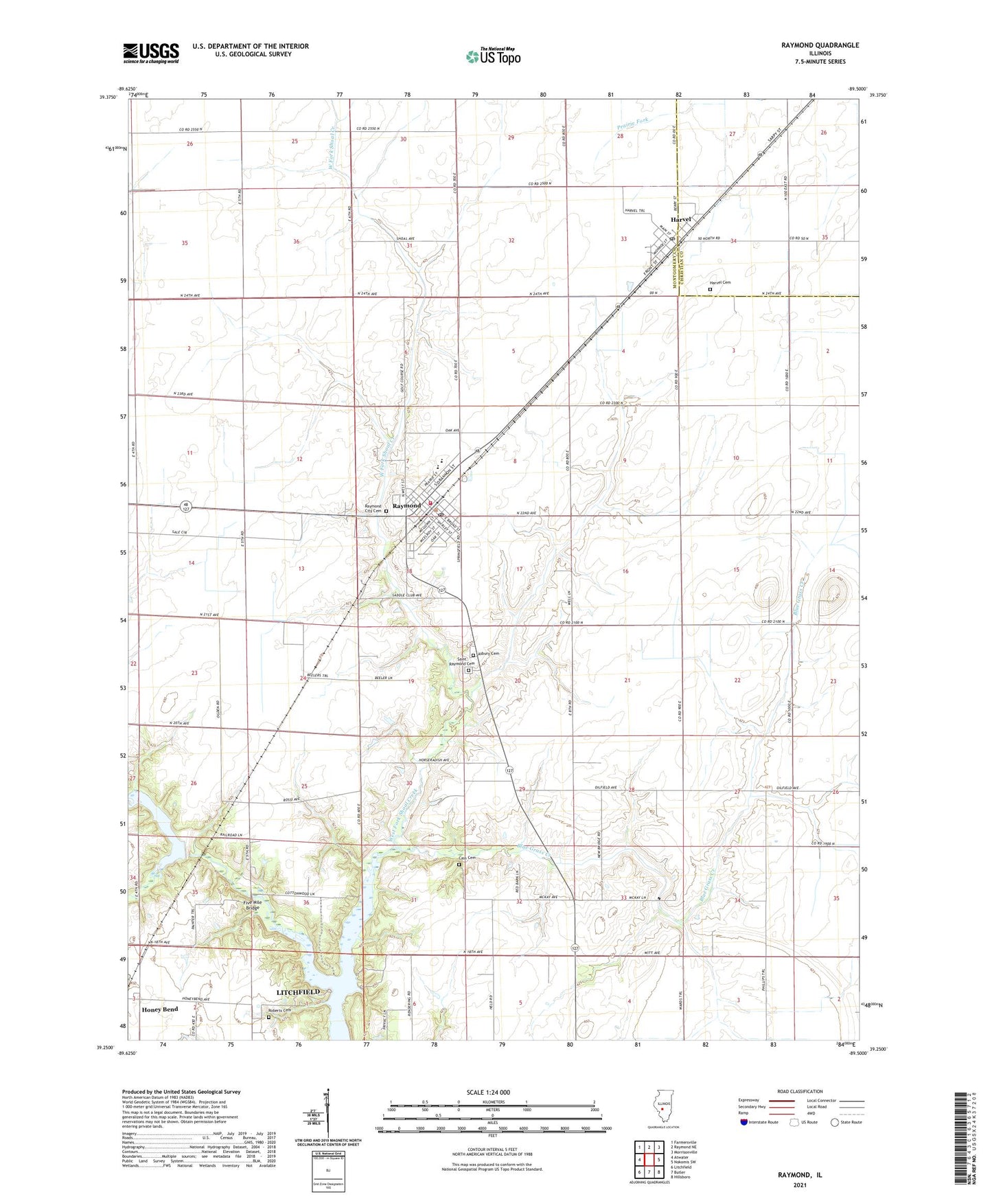
2024 topographic map quadrangle Raymond in the state of Illinois. Scale: 1:24000. Based on the newly updated USGS 7.5' US Topo map series, this map is in the following counties: Montgomery, Christian. The map contains contour data, water features, and other items you are used to seeing on USGS maps, but also has updated roads and other features. This is the next generation of topographic maps. Printed on high-quality waterproof paper with UV fade-resistant inks.
Quads adjacent to this one:
West: Atwater
Northwest: Farmersville
North: Raymond NE
Northeast: Morrisonville
East: Nokomis SW
Southeast: Hillsboro
South: Butler
Southwest: Litchfield
This map covers the same area as the classic USGS quad with code o39089c5.
Contains the following named places: Asbury Cemetery, Blue Grass Creek, Blue Grass School, Blue Mound Church, Burnett School, Cass Cemetery, Five Mile Bridge, Fivemile Lake, Guthrie School, Harmony School, Harvel, Harvel Cemetery, Harvel Post Office, Hazel Green School, Honey Bend, Independent School, Lebeck Landing Strip, Liberty School, Lilly School, Lincolnwood High School, Raymond, Raymond - Harvel Fire Department, Raymond Christian Church, Raymond City Cemetery, Raymond Grade School, Raymond Harvel Ambulance Service, Raymond Post Office, Raymond United Methodist Church, Roberts Cemetery, Roberts Cemetery Savanna Nature Preserve, Saint Raymond Cemetery, Shoal Creek Farm, Shoal Creek Watershed Structure Number 2 Dam, Threemile Branch, Township of Raymond, Village of Harvel, Village of Raymond, WSMI-FM (Litchfield), ZIP Codes: 62538, 62560