MyTopo
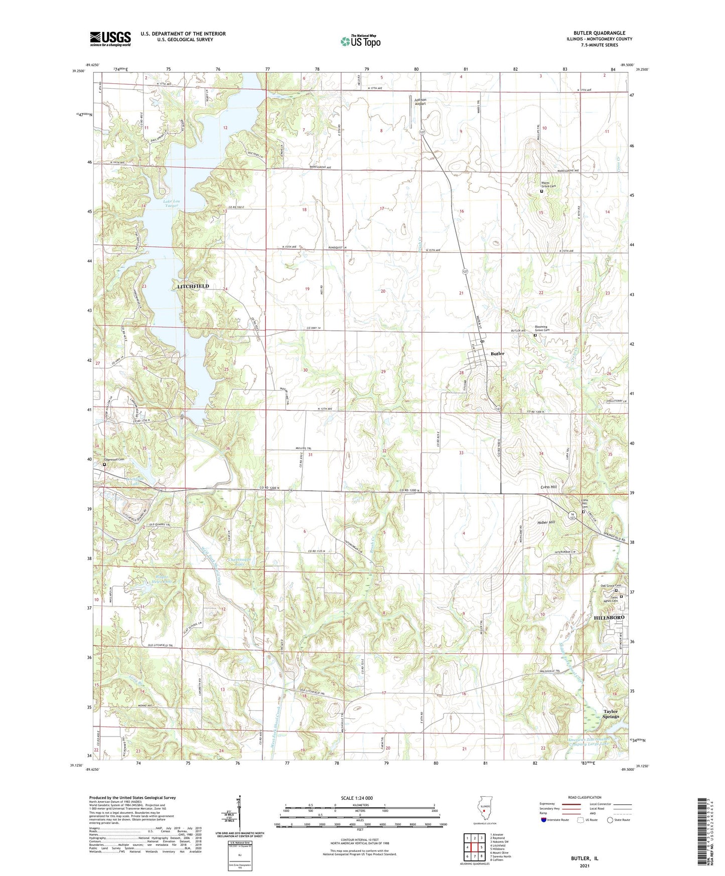
Butler Illinois US Topo Map
Couldn't load pickup availability
2024 topographic map quadrangle Butler in the state of Illinois. Scale: 1:24000. Based on the newly updated USGS 7.5' US Topo map series, this map is in the following counties: Montgomery. The map contains contour data, water features, and other items you are used to seeing on USGS maps, but also has updated roads and other features. This is the next generation of topographic maps. Printed on high-quality waterproof paper with UV fade-resistant inks.
Quads adjacent to this one:
West: Litchfield
Northwest: Atwater
North: Raymond
Northeast: Nokomis SW
East: Hillsboro
Southeast: Coffeen
South: Sorento North
Southwest: Mount Olive
This map covers the same area as the classic USGS quad with code o39089b5.
Contains the following named places: American Zinc Smelter Company Large Lake, American Zinc Smelter Company Large Lake Dam, Beckemeyer Elementary School, Blooming Grove Cemetery, Brush Branch School, Brush Creek, Butler, Butler Post Office, Chautauqua Lake, Chautauqua Park, Cherry Grove School, City of Litchfield, Cress Creek, Cress Hill, Cress Hill Cemetery, Edgewood Cemetery, Enterprise School, Flat School, Huber Hill, Island View, Justison Airport, Lake Lou Yaeger, Lake Lou Yaeger Dam, Litchfield City Lake Dam, Litchfield Lake, Marina Number 1, Marina Number 2, Mount Gilead School, Oak Grove Cemetery, Oak Grove School, Rainmaker Camp, Saint Agnes Cemetery, Shoal Creek Nature Conservation Area, Shoal Creek Watershed Impoundment Reservoir, Stagecoach Junction, Sunrise Hills, Township of Butler Grove, Township of Hillsboro, Victory School, Village of Butler, Ware Grove School, Wares Grove Cemetery, Wares Grove Church, Wayne Helen Lake, Wayne Helen Lake Dam, Woodsboro Community Center, Woodsboro School, WSMI-AM (Litchfield), ZIP Code: 62015