MyTopo
Barry Illinois US Topo Map
Couldn't load pickup availability
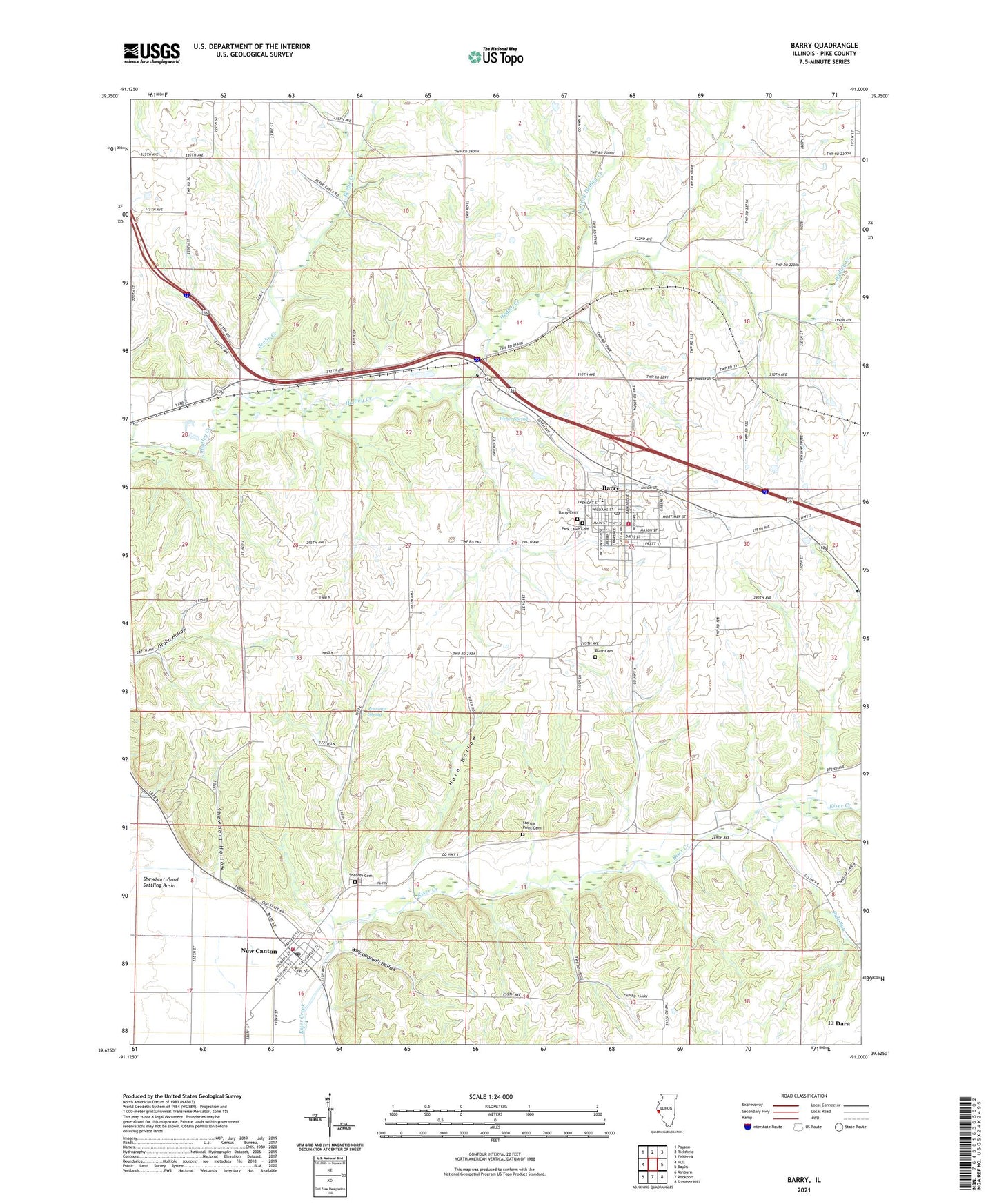
2024 topographic map quadrangle Barry in the state of Illinois. Scale: 1:24000. Based on the newly updated USGS 7.5' US Topo map series, this map is in the following counties: Pike. The map contains contour data, water features, and other items you are used to seeing on USGS maps, but also has updated roads and other features. This is the next generation of topographic maps. Printed on high-quality waterproof paper with UV fade-resistant inks.
Quads adjacent to this one:
West: Hull
Northwest: Payson
North: Richfield
Northeast: Fishhook
East: Baylis
Southeast: Summer Hill
South: Rockport
Southwest: Ashburn
This map covers the same area as the classic USGS quad with code o39091f1.
Contains the following named places: Barry, Barry Balloonport, Barry Cemetery, Barry Fire Protection District, Barry High School, Barry Historic District, Barry Post Office, Beebe Creek, Blair Cemetery, Bluegrass School, Bowler School, Buckeye School, Bull Run, City of Barry, Collins School, Gully Landing Strip, Guss School, Holy Redeemer Church, Horn Hollow, Jennings Spring, Mound School, New Canton, New Canton Fire Protection District, New Canton Post Office, New Canton Station, North Fork Hadley Creek, Oak Grove School, Park Lawn Cemetery, Pike County Sheriff's Office - Barry Station, Potter Airport, Shearer Cemetery, Shewhart Hollow, Spring School, Spring Valley School, Stoney Point Cemetery, Stony Point School, Town of New Canton, Township of Barry, Weber Spring, Whippoorwill Hollow, Whittleton School, Williams School, Woodruff Cemetery, ZIP Code: 62312