MyTopo
Fishhook Illinois US Topo Map
Couldn't load pickup availability
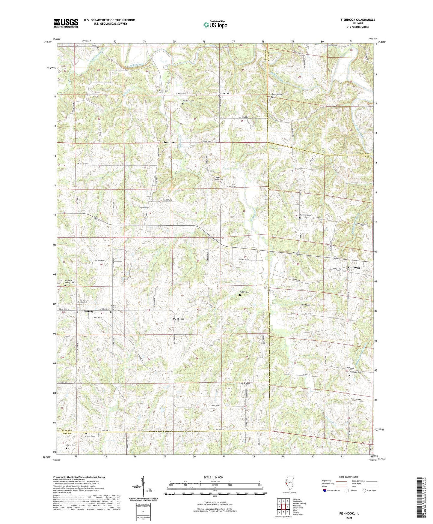
2024 topographic map quadrangle Fishhook in the state of Illinois. Scale: 1:24000. Based on the newly updated USGS 7.5' US Topo map series, this map is in the following counties: Adams, Pike, Brown. The map contains contour data, water features, and other items you are used to seeing on USGS maps, but also has updated roads and other features. This is the next generation of topographic maps. Printed on high-quality waterproof paper with UV fade-resistant inks.
Quads adjacent to this one:
West: Richfield
Northwest: Liberty
North: Kellerville
Northeast: Mount Sterling
East: Perry West
Southeast: New Salem
South: Baylis
Southwest: Barry
This map covers the same area as the classic USGS quad with code o39090g8.
Contains the following named places: Beverly, Beverly Census Designated Place, Beverly Old Cemetery, Bowman Cemetery, Chestline, Crabapple Creek, East School, Fairmount School, Fairview Cemetery, Ferguson Ford, Fishhook, Fishhook Creek, Greenwood School, Highland School, Kurfman Cemetery, Lanes Branch, Little Missouri Creek, Long Ridge, Mayfield Family Cemetery, Mixer Family Cemetery, Mound Prairie Cemetery, Mound Prairie Church, Mound School, Oak Grove School, Perrigo Cemetery, Pierce Cemetery, Pleasant Hill School, Reddick School, Rubart Cemetery, Seybold Cemetery, The Mound, Township of Beverly, Whitaker Cemetery, Winner Cemetery, Woodland Cemetery, Woodland Church, Woodland School, ZIP Code: 62314