MyTopo
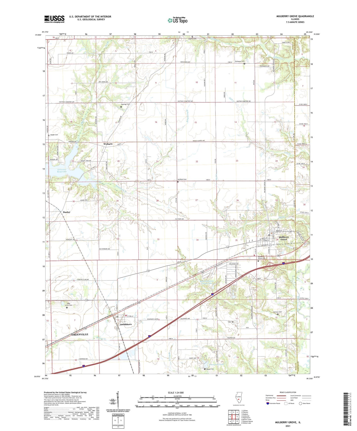
Mulberry Grove Illinois US Topo Map
Couldn't load pickup availability
2024 topographic map quadrangle Mulberry Grove in the state of Illinois. Scale: 1:24000. Based on the newly updated USGS 7.5' US Topo map series, this map is in the following counties: Bond, Fayette. The map contains contour data, water features, and other items you are used to seeing on USGS maps, but also has updated roads and other features. This is the next generation of topographic maps. Printed on high-quality waterproof paper with UV fade-resistant inks.
Quads adjacent to this one:
West: Greenville
Northwest: Coffeen
North: Fillmore
Northeast: Bingham
East: Hagarstown
Southeast: Wildcat Lake
South: Pleasant Mound
Southwest: Beaver Creek
This map covers the same area as the classic USGS quad with code o38089h3.
Contains the following named places: Armstrong Pond, Armstrong Pond Dam, Bond Camp, Bond Christan Camp Lake Dam, Bond Christian Camp Lake, Camp Shadrack, Cemetery, Concord School, Dry Branch, Dunkard Cemetery, Durham Cemetery, Durley, Durley Camp, Etcheson Cemetery, First Baptist Church, First Church of Christ, Governor Bond Lake, Greenville New City Lake, Griggs School, Halls Grove Cemetery, Halls Grove School, Hastings Cemetery, Hubbard School, Liberty Cemetery, Mahle School, Maxey Cemetery, Midwest Camp, Mulberry Grove, Mulberry Grove Cemetery, Mulberry Grove Fire Protection District, Mulberry Grove Post Office, Mulberry Grove Senior High School, Persimmon Grove School, Pleasant View School, Rhea School, Royal Lake Resort, Seagraves School, Smithboro, Smithboro Fire Protection District, Smithboro Post Office, Stone Pond, Stone Pond Dam, Township of Mulberry Grove, Village of Mulberry Grove, Village of Smithboro, Woburn, Woburn Consolidated Oil Field, Wright Cemetery, Zion Church, ZIP Codes: 62262, 62284