MyTopo
Blyton Illinois US Topo Map
Couldn't load pickup availability
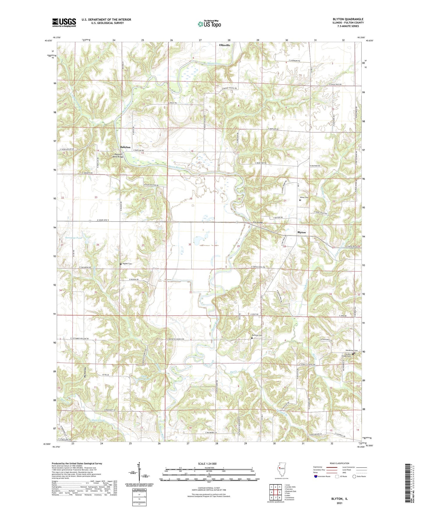
2024 topographic map quadrangle Blyton in the state of Illinois. Scale: 1:24000. Based on the newly updated USGS 7.5' US Topo map series, this map is in the following counties: Fulton. The map contains contour data, water features, and other items you are used to seeing on USGS maps, but also has updated roads and other features. This is the next generation of topographic maps. Printed on high-quality waterproof paper with UV fade-resistant inks.
Quads adjacent to this one:
West: Bushnell East
Northwest: Avon
North: London Mills
Northeast: Fairview
East: Fiatt
Southeast: Lewistown
South: Smithfield
Southwest: Adair
This map covers the same area as the classic USGS quad with code o40090e3.
Contains the following named places: Aylesworth Branch, Babylon, Babylon Bend Bridge, Babylon School, Baughman School, Big Hollow, Blout Centennial Farm, Blyton, Blyton Post Office, Buckeye, Buckeye Bridge, Buckeye Cemetery, Buckeye Church, Buckeye School, Clyde Darst Pond, Clyde Darst Pond Dam, Franklin School, Henderson Cemetery, Henderson School, Laswell Branch, Lost Grove Creek, Mount Pisgah County Park, Mount Pleasant School, Pleasant Valley School, Put Creek, Rigdon Cemetery, Shoal Creek, Shoofly School, Sinnett Chapel, Sinnett Chapel Cemetery, Sweeney School, Sweeneys Pond, Sweeneys Pond Dam, Templars Hall, Township of Deerfield, Turkey Creek, Victory School, Whiteoak Grove School, Whites Ferry, Wiley Cemetery, Wiley Evangelical Lutheran Church, Wiley School, Williams School, Ziltz Bridge, ZIP Code: 61431