MyTopo
Chapin Illinois US Topo Map
Couldn't load pickup availability
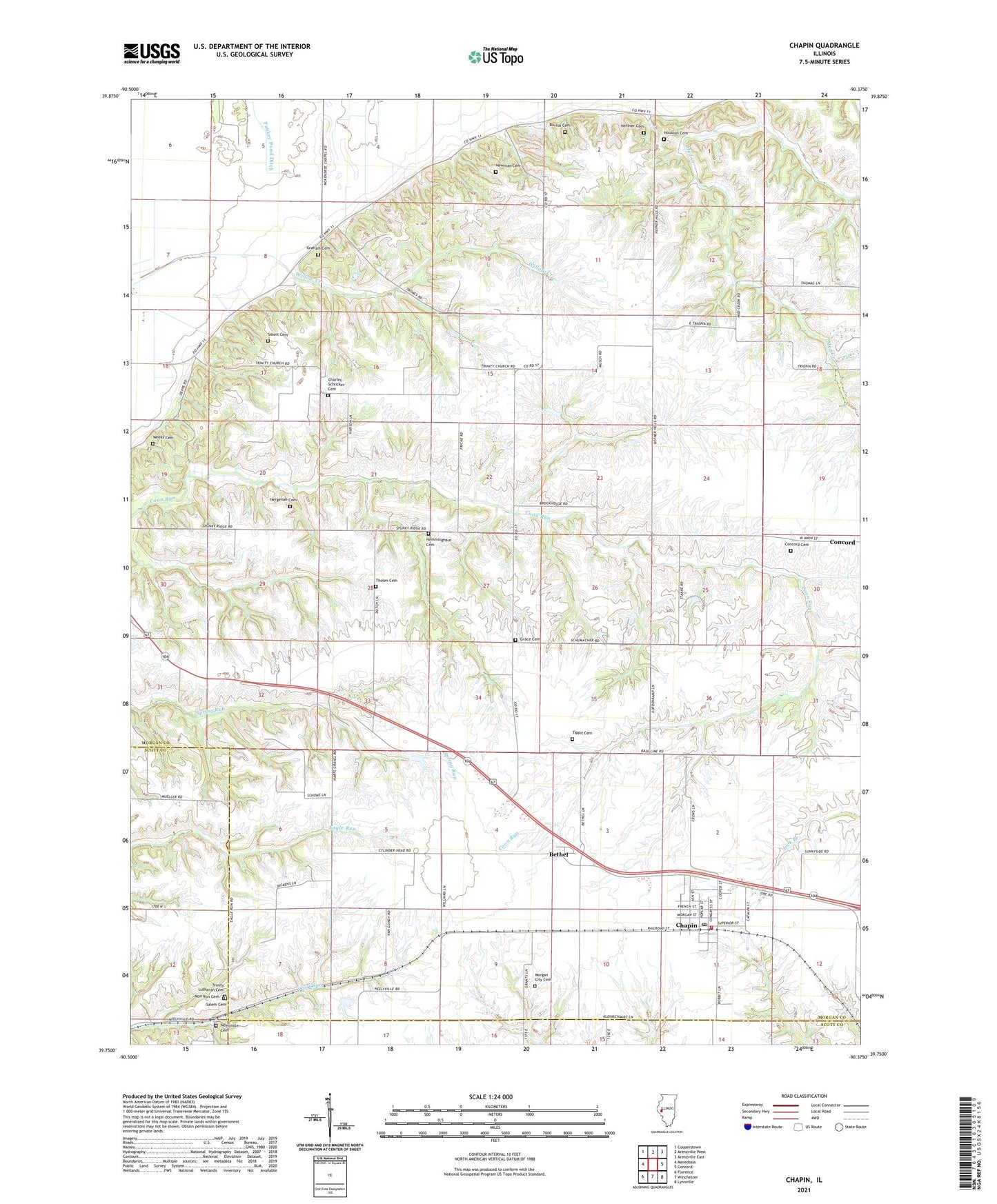
2024 topographic map quadrangle Chapin in the state of Illinois. Scale: 1:24000. Based on the newly updated USGS 7.5' US Topo map series, this map is in the following counties: Morgan, Scott, Cass. The map contains contour data, water features, and other items you are used to seeing on USGS maps, but also has updated roads and other features. This is the next generation of topographic maps. Printed on high-quality waterproof paper with UV fade-resistant inks.
Quads adjacent to this one:
West: Meredosia
Northwest: Cooperstown
North: Arenzville West
Northeast: Arenzville East
East: Concord
Southeast: Lynnville
South: Winchester
Southwest: Florence
This map covers the same area as the classic USGS quad with code o39090g4.
Contains the following named places: Baker School, Bethel, Burns School, Burrus Cemetery, Chapin, Chapin Election Precinct, Chapin Farmers Elevator, Chapin Post Office, Chapin Rural Fire Association, Chapin Volunteer Fire Department, Charles Schlicker Cemetery, Concord Cemetery, Eagle School, Grace Cemetery, Graham Cemetery, Hazel Dell School, Heffner Cemetery, Hemminghaus Cemetery, Hickory Grove School, Hopewell School, Houston Cemetery, Lakeview School, McKendree Chapel, Meredosia Hill Prairie Nature Preserve, Morgan City, Morgan City Cemetery, Morrison Cemetery, Mud Creek, Neelyville, Neelyville Cemetery, Nergenah Cemetery, Newman Cemetery, Oakdale School, Pleasant View School, Saint Paul's Lutheran Church, Salem Cemetery, Sibert Cemetery, Tholen Cemetery, Thompson School, Tippit Cemetery, Trinity Church, Trinity Lutheran Cemetery, Trinity Lutheran Church, Victory School, Village of Chapin, Weeks Cemetery, ZIP Code: 62628