MyTopo
Concord Illinois US Topo Map
Couldn't load pickup availability
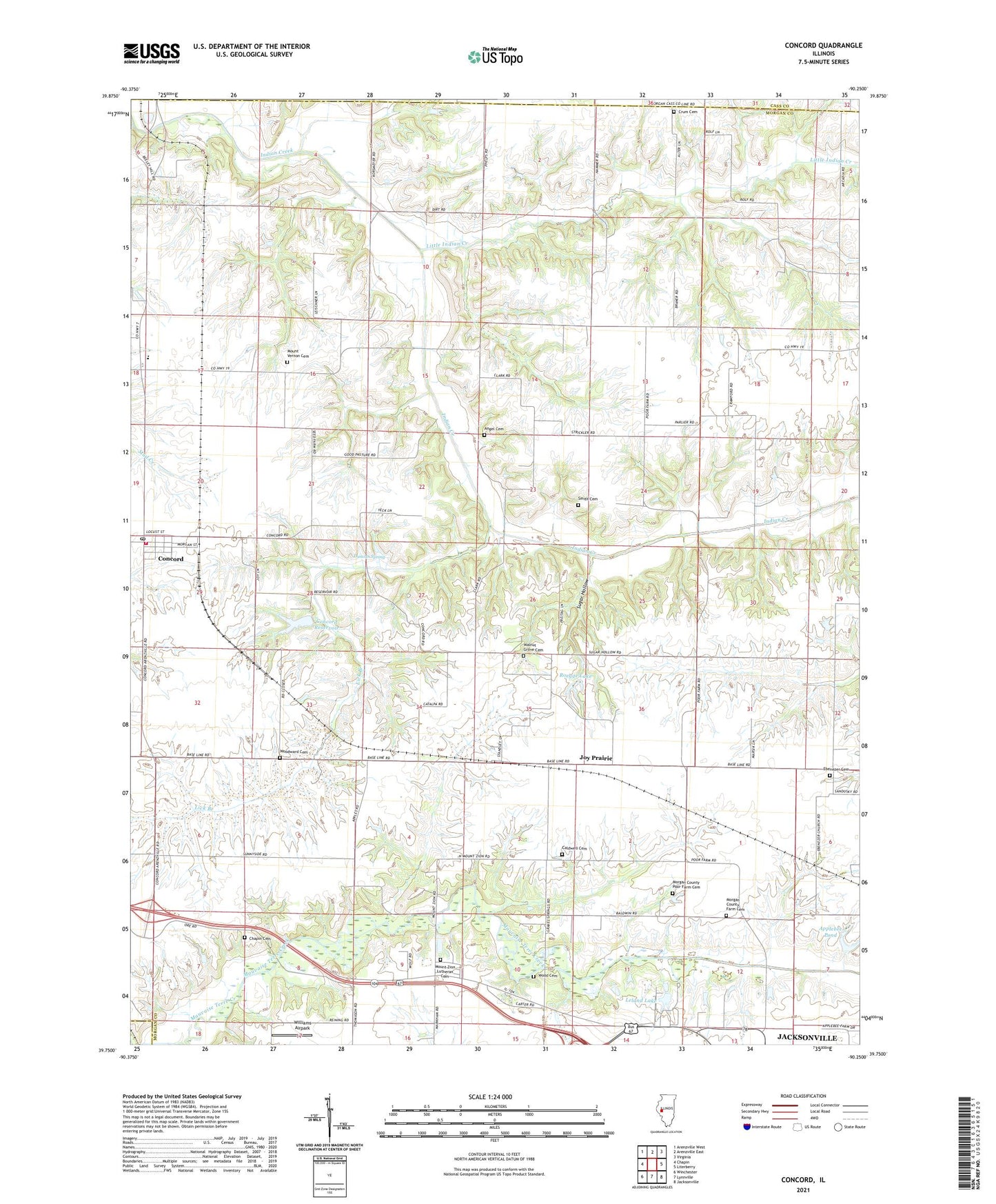
2024 topographic map quadrangle Concord in the state of Illinois. Scale: 1:24000. Based on the newly updated USGS 7.5' US Topo map series, this map is in the following counties: Morgan, Cass, Scott. The map contains contour data, water features, and other items you are used to seeing on USGS maps, but also has updated roads and other features. This is the next generation of topographic maps. Printed on high-quality waterproof paper with UV fade-resistant inks.
Quads adjacent to this one:
West: Chapin
Northwest: Arenzville West
North: Arenzville East
Northeast: Virginia
East: Literberry
Southeast: Jacksonville
South: Lynnville
Southwest: Winchester
This map covers the same area as the classic USGS quad with code o39090g3.
Contains the following named places: Angel Cemetery, Applebee Pond, Applebee Pond Dam, Arcadia Election Precinct, Caldwell Cemetery, Chapin Cemetery, Concord, Concord Christian Church, Concord Election Precinct, Concord Post Office, Concord Reservoir, Concord Reservoir Dam, Concord United Methodist Church, Concord Volunteer Fire Department, Crum Cemetery, Duncan Spring, Duncan Springs School, Ebenezer Cemetery, Ebenezer Church, Ebenezer School, Grace Chapel, Harmony School, Jersey College School, Joy Prairie, Kinnan School, Leland Lake, Lick Branch, Little Indian Creek, Morgan County Farm Cemetery, Morgan County Poor Farm Cemetery, Mount Vernon Cemetery, Mount Vernon School, Mount Zion Church, Mount Zion Lutheran Cemetery, North Union School, Pleasant Grove School, Roegge Lake, Smith Cemetery, Sugar Hollow, Sunnyside School, Triopia Junior-Senior High School, Union School, Village of Concord, Walnut Grove Cemetery, Walnut Grove School, Werries Airport, Whiteoak Grove School, Williams Airpark, Wood Cemetery, Woodward Cemetery, ZIP Code: 62631