MyTopo
Cooperstown Illinois US Topo Map
Couldn't load pickup availability
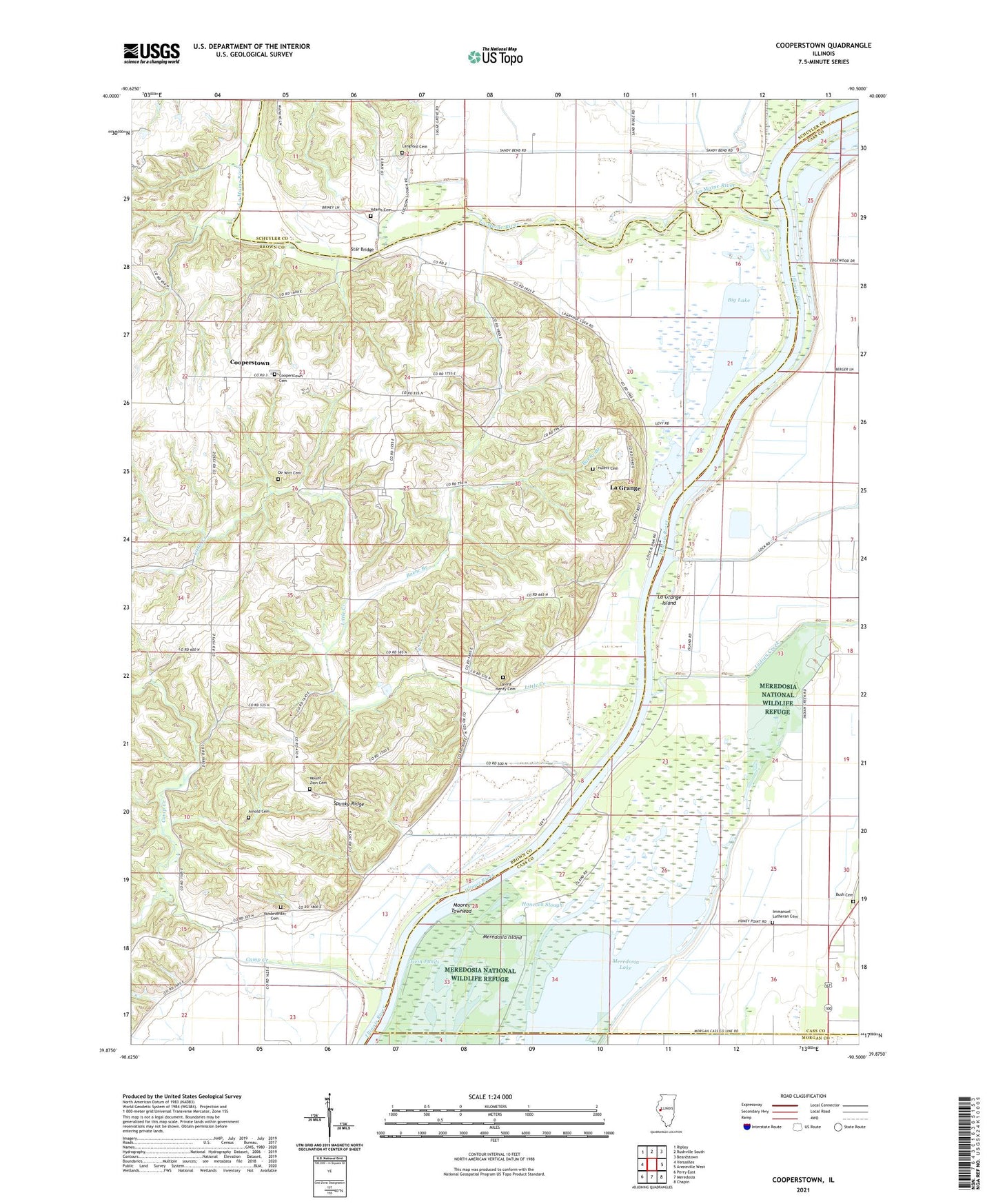
2024 topographic map quadrangle Cooperstown in the state of Illinois. Scale: 1:24000. Based on the newly updated USGS 7.5' US Topo map series, this map is in the following counties: Brown, Cass, Schuyler, Morgan. The map contains contour data, water features, and other items you are used to seeing on USGS maps, but also has updated roads and other features. This is the next generation of topographic maps. Printed on high-quality waterproof paper with UV fade-resistant inks.
Quads adjacent to this one:
West: Versailles
Northwest: Ripley
North: Rushville South
Northeast: Beardstown
East: Arenzville West
Southeast: Chapin
South: Meredosia
Southwest: Perry East
This map covers the same area as the classic USGS quad with code o39090h5.
Contains the following named places: Adams Cemetery, Adams School, Arnold Cemetery, Baehr Branch, Big Lake, Bond School, Briggs Landing Post Light, Bush Cemetery, Camp Creek, Cooperstown, Cooperstown Cemetery, De Witt Cemetery, De Witts School, Elbow Lake, Hancock Slough, Hulett Cemetery, Immanuel Church, Immanuel Lutheran Cemetery, Indian Creek, Island School, Kloker Airport, La Grange, La Grange Island, La Grange Lock and Dam, La Grange Locks, La Grange Pool, La Grange School, La Moine River, Langford Cemetery, Lavina Henry Cemetery, Little Creek, Long Lake, Lydia School, Meredosia Island, Moores Towhead, Mount Zion Cemetery, Mount Zion Church, Perkins Lake, Petri School, Reich Landing, Richland School, Sneider Landing Strip, South Beardstown Pumping Station, Spunky Ridge, Star Bridge, Township of Cooperstown, Township of Versailles, Twin Ponds, Vandeventer Cemetery, Vandeventer School