MyTopo
Meredosia Illinois US Topo Map
Couldn't load pickup availability
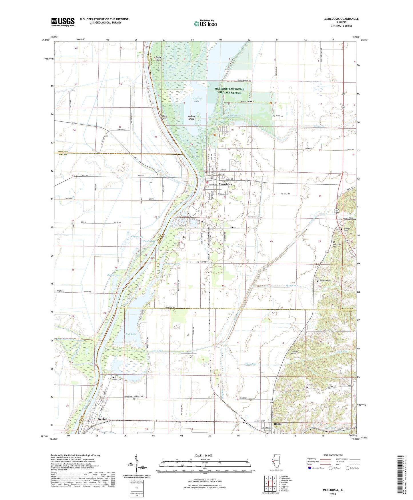
2024 topographic map quadrangle Meredosia in the state of Illinois. Scale: 1:24000. Based on the newly updated USGS 7.5' US Topo map series, this map is in the following counties: Morgan, Scott, Pike, Brown. The map contains contour data, water features, and other items you are used to seeing on USGS maps, but also has updated roads and other features. This is the next generation of topographic maps. Printed on high-quality waterproof paper with UV fade-resistant inks.
Quads adjacent to this one:
West: Perry East
Northwest: Versailles
North: Cooperstown
Northeast: Arenzville West
East: Chapin
Southeast: Winchester
South: Florence
Southwest: Griggsville
This map covers the same area as the classic USGS quad with code o39090g5.
Contains the following named places: Augustine Cemetery, Barlow Lake, Billings Lake, Bluffs, Bluffs High School, Bluffs Post Office, Bluffs United Methodist Church, Burns School, Carver Lake, Chisel Lake, Collins Cemetery, Columbus, Coon Run, Eagle Island, Eagle Run, Fairview Cemetery, First Baptist Church, Hodges Cemetery, Kiel Cemetery, McCaleb Cemetery, McGees Island, McKee Creek, Meredosia, Meredosia City Rescue Squad, Meredosia Fire Department, Meredosia Lake, Meredosia National Wildlife Refuge, Meredosia Number 1 Election Precinct, Meredosia Number 2 Election Precinct, Meredosia Post Office, Meredosia Power Station, Meredosia-Chambersburg High School, Naples, Naples Cemetery, New Salem Cemetery, Oakland Cemetery, Saint John's Lutheran Church, Saint Patrick Catholic Church, Sand Ridge School, Seamans Pond, Shady Acres, Smith Lake, South Fork McKee Creek, Spring Run, Sycamore School, Town of Naples, Unique School, Village of Meredosia, Willow Creek, Wilsons Island, Wolf Run, Woods Lake, ZIP Code: 62665