MyTopo
Clarksdale Illinois US Topo Map
Couldn't load pickup availability
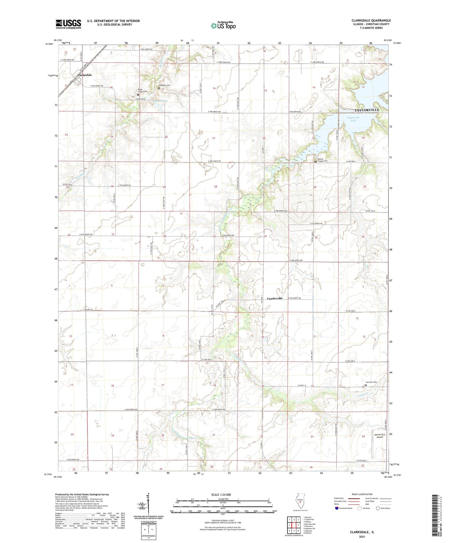
2024 topographic map quadrangle Clarksdale in the state of Illinois. Scale: 1:24000. Based on the newly updated USGS 7.5' US Topo map series, this map is in the following counties: Christian. The map contains contour data, water features, and other items you are used to seeing on USGS maps, but also has updated roads and other features. This is the next generation of topographic maps. Printed on high-quality waterproof paper with UV fade-resistant inks.
Quads adjacent to this one:
West: Morrisonville
Northwest: Kincaid
North: Taylorville
Northeast: Willeys
East: Owaneco
Southeast: Ohlman
South: Nokomis
Southwest: Nokomis SW
This map covers the same area as the classic USGS quad with code o39089d3.
Contains the following named places: Anderson Cemetery, B P Flower Farm, Brush Creek Cemetery, Center School, Clarksdale, Cotton Creek, Douglas School, Fairview Cemetery, Fairview Church, Hazel Green School, Johnson Townhall, Kleinik RLA Airport, Lake Shore Golf Club, Lake Taylorville, Locust Creek, Lusters Lake, Lusters Lake Dam, Mound Chapel, Mound Chapel Cemetery, Mound School, Oak Ridge School, Providence Church, Sassafras School, Skinner School, Superior School, Taylorville Lake, Township of Greenwood, Township of Johnson, Vanderville, Wenzler School