MyTopo
Nokomis SW Illinois US Topo Map
Couldn't load pickup availability
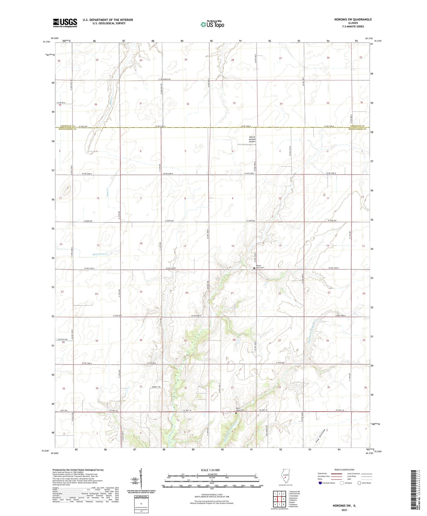
2024 topographic map quadrangle Nokomis SW in the state of Illinois. Scale: 1:24000. Based on the newly updated USGS 7.5' US Topo map series, this map is in the following counties: Montgomery, Christian. The map contains contour data, water features, and other items you are used to seeing on USGS maps, but also has updated roads and other features. This is the next generation of topographic maps. Printed on high-quality waterproof paper with UV fade-resistant inks.
Quads adjacent to this one:
West: Raymond
Northwest: Raymond NE
North: Morrisonville
Northeast: Clarksdale
East: Nokomis
Southeast: Bald Knob
South: Hillsboro
Southwest: Butler
This map covers the same area as the classic USGS quad with code o39089c4.
Contains the following named places: Alan B Janssen Airport, Ash Grove School, Craig School, Fawn Creek School, Gragg School, Green Valley School, Hillsboro Gas Storage Area, Lakeside School, Miller School, Mount Zion Church, Oak Grove School, Prairie School, Saint John Church, Saint Johns Cemetery, Shoal Creek School, Shore School, Tester School, Township of Rountree, Union Brick School, Union School