MyTopo
Nokomis Illinois US Topo Map
Couldn't load pickup availability
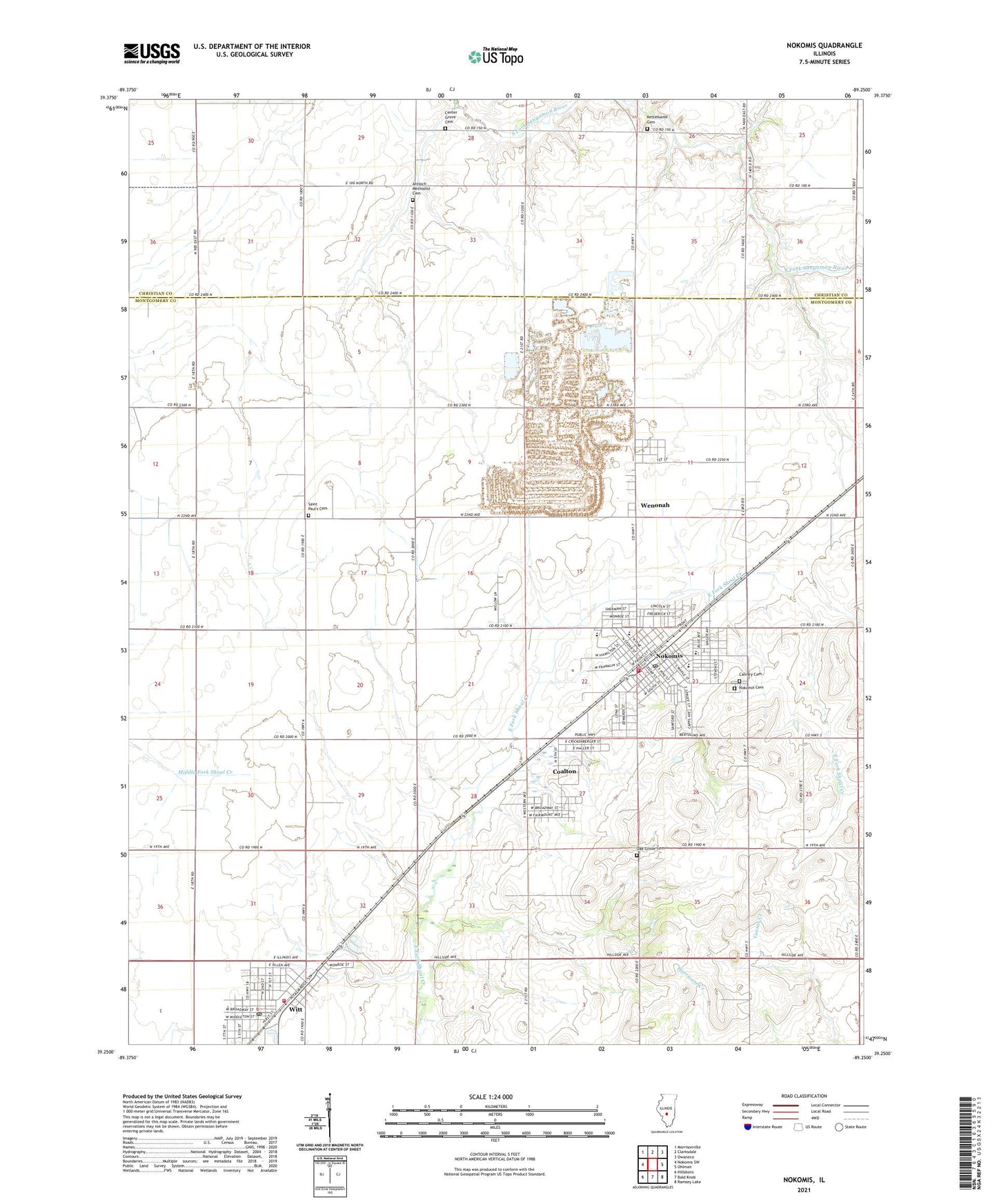
2024 topographic map quadrangle Nokomis in the state of Illinois. Scale: 1:24000. Based on the newly updated USGS 7.5' US Topo map series, this map is in the following counties: Montgomery, Christian. The map contains contour data, water features, and other items you are used to seeing on USGS maps, but also has updated roads and other features. This is the next generation of topographic maps. Printed on high-quality waterproof paper with UV fade-resistant inks.
Quads adjacent to this one:
West: Nokomis SW
Northwest: Morrisonville
North: Clarksdale
Northeast: Owaneco
East: Ohlman
Southeast: Ramsey Lake
South: Bald Knob
Southwest: Hillsboro
This map covers the same area as the classic USGS quad with code o39089c3.
Contains the following named places: Antioch Methodist Cemetery, Avoca School, Bowser School, Calvary Cemetery, Center Grove Cemetery, Christian Church of Witt, City of Nokomis, City of Witt, Coalton, Compton School, Dahler Airport, Dooley Field, Fair Prairie School, First Baptist Church, First Methodist Church, German Methodist Episcopal Church, Gopher Hills School, Hillside Baptist Church, J and J Farms Airport, Kettelkamp Cemetery, Kottwitz Landing Strip, Lynnvue Farms, Memorial Park, Nokomis, Nokomis Fire Protection District, Nokomis High School, Nokomis Police Department, Nokomis Post Office, Nokomis Public Library, Nokomis Quarry, Nokomis South Middle School, Nokomis Witt Area Ambulance Service, North Elementary School, Oak Grove Cemetery, Oak Grove School, Reliance Mine Number 9, Saint Louis Catholic Church, Saint Louis School, Saint Marks Lutheran Church, Saint Paul School, South Fork United Methodist Church, Township of Nokomis, Trinity Evangelical Lutheran Church, Village of Coalton, Village of Wenonah, Walker School, Wenonah, Witt, Witt High School, Witt Memorial Public Library, Witt Post Office, Witt Volunteer Fire Department, ZIP Code: 62075