MyTopo
Morrisonville Illinois US Topo Map
Couldn't load pickup availability
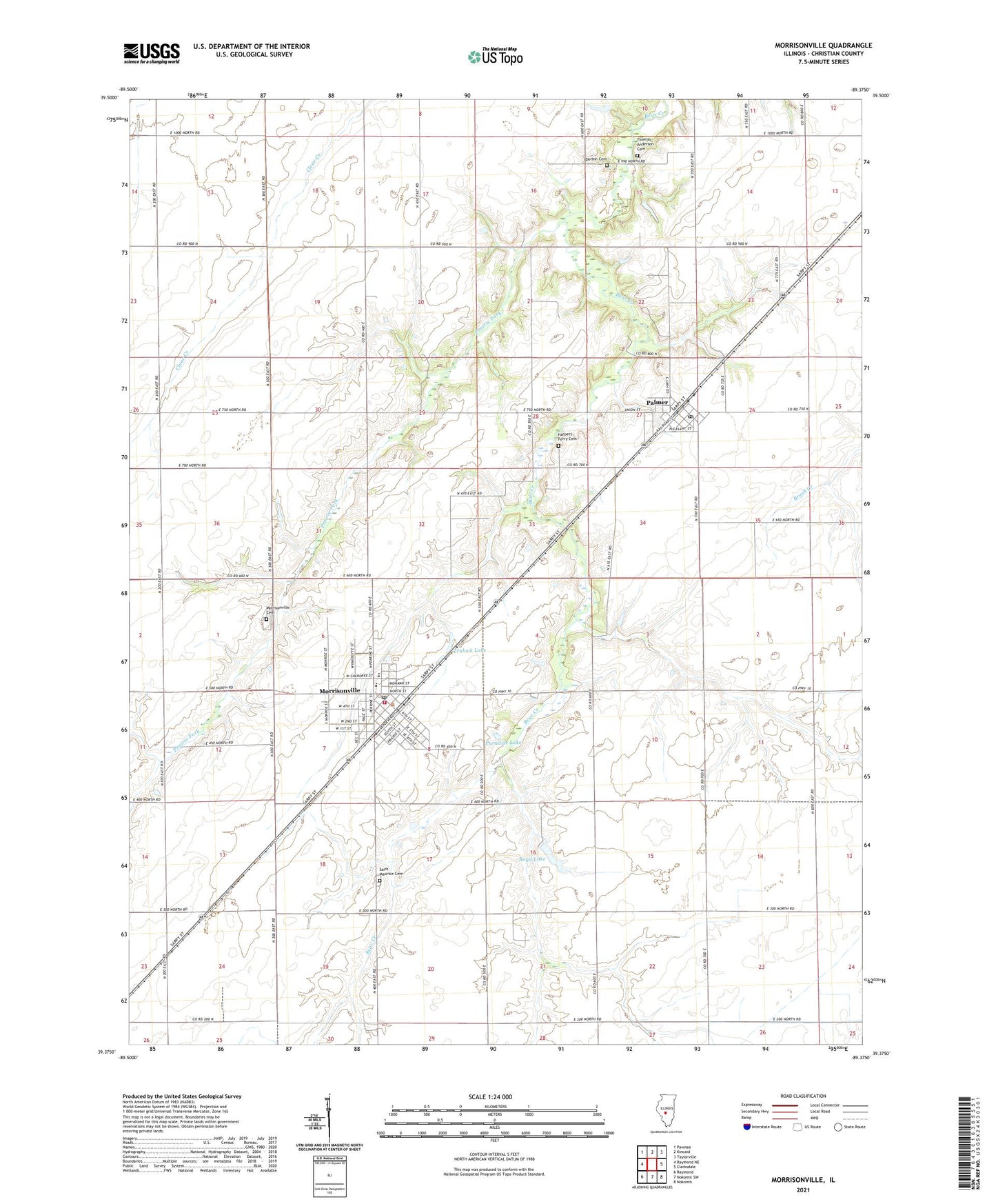
2024 topographic map quadrangle Morrisonville in the state of Illinois. Scale: 1:24000. Based on the newly updated USGS 7.5' US Topo map series, this map is in the following counties: Christian. The map contains contour data, water features, and other items you are used to seeing on USGS maps, but also has updated roads and other features. This is the next generation of topographic maps. Printed on high-quality waterproof paper with UV fade-resistant inks.
Quads adjacent to this one:
West: Raymond NE
Northwest: Pawnee
North: Kincaid
Northeast: Taylorville
East: Clarksdale
Southeast: Nokomis
South: Nokomis SW
Southwest: Raymond
This map covers the same area as the classic USGS quad with code o39089d4.
Contains the following named places: Boyd Lake, Boyd Lake Dam, Brookside School, Central School, D'Arcy School, Durbin Cemetery, First Baptist Church, Harpers Ferry Cemetery, Morrisonville, Morrisonville Cemetery, Morrisonville Community Ambulance Service, Morrisonville Grade School, Morrisonville High School, Morrisonville Palmer Fire Protection District, Morrisonville Post Office, Palmer, Palmer Post Office, Paradise Lake, Paradise Lake Dam, Prairie Fork, Prosperity School, Saint Maurice Catholic Church, Saint Maurice Cemetery, Saint Maurice School, Silver Grove School, Thomas Anderson Cemetery, Township of Bear Creek, Township of Ricks, Trulock Lake, United Methodist Church of Morrisonville, Vancil Farm, Village of Morrisonville, Village of Palmer, Willow Vale School, ZIP Codes: 62546, 62556