MyTopo
Virginia Illinois US Topo Map
Couldn't load pickup availability
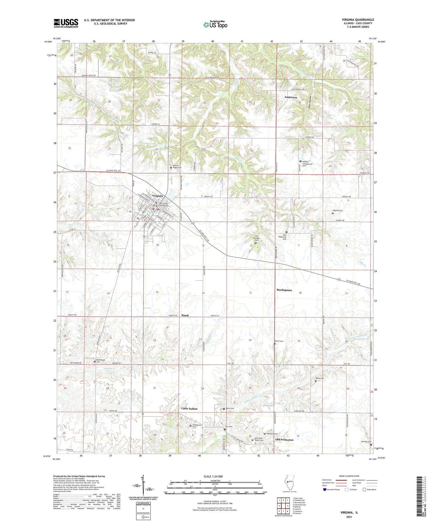
2024 topographic map quadrangle Virginia in the state of Illinois. Scale: 1:24000. Based on the newly updated USGS 7.5' US Topo map series, this map is in the following counties: Cass. The map contains contour data, water features, and other items you are used to seeing on USGS maps, but also has updated roads and other features. This is the next generation of topographic maps. Printed on high-quality waterproof paper with UV fade-resistant inks.
Quads adjacent to this one:
West: Arenzville East
Northwest: Clear Lake
North: Chandlerville
Northeast: Newmansville
East: Ashland
Southeast: Prentice
South: Literberry
Southwest: Concord
This map covers the same area as the classic USGS quad with code o39090h2.
Contains the following named places: Anderson, Assembly of God Church, Beard Cemetery, Berry Cemetery, Bethlehem Cemetery, Bethlehem School, Black Cemetery, Buck Hollow, Burlingame, Campbell School, Cass County, Cass County Courthouse, Cass County Sheriff's Office, City of Virginia, Dunaway Park, First Baptist Church, First Presbyterian Church, Grace Lutheran Church, Hall School, Harding Cemetery, Holmes Campground Cemetery, Hopkins Cemetery, John Epler Taylor Cemetery, John Robertson Cemetery, Kisch, Levi Springer Cemetery, Little Indian, Mecca Paramedics, Old Princeton, Olive Branch School, Robinson Cemetery, Saint Lukes Catholic Church, Springer School, Stephenson Cemetery, Sugar Grove School, Township of Virginia, Virginia, Virginia High School, Virginia Lake, Virginia Lake Dam, Virginia Police Department, Virginia Post Office, Virginia United Methodist Church, Virginia Volunteer Fire Department, Walnut Grove School, Walnut Ridge Cemetery, Zion Cemetery, Zion Church, ZIP Code: 62691