MyTopo
Versailles Illinois US Topo Map
Couldn't load pickup availability
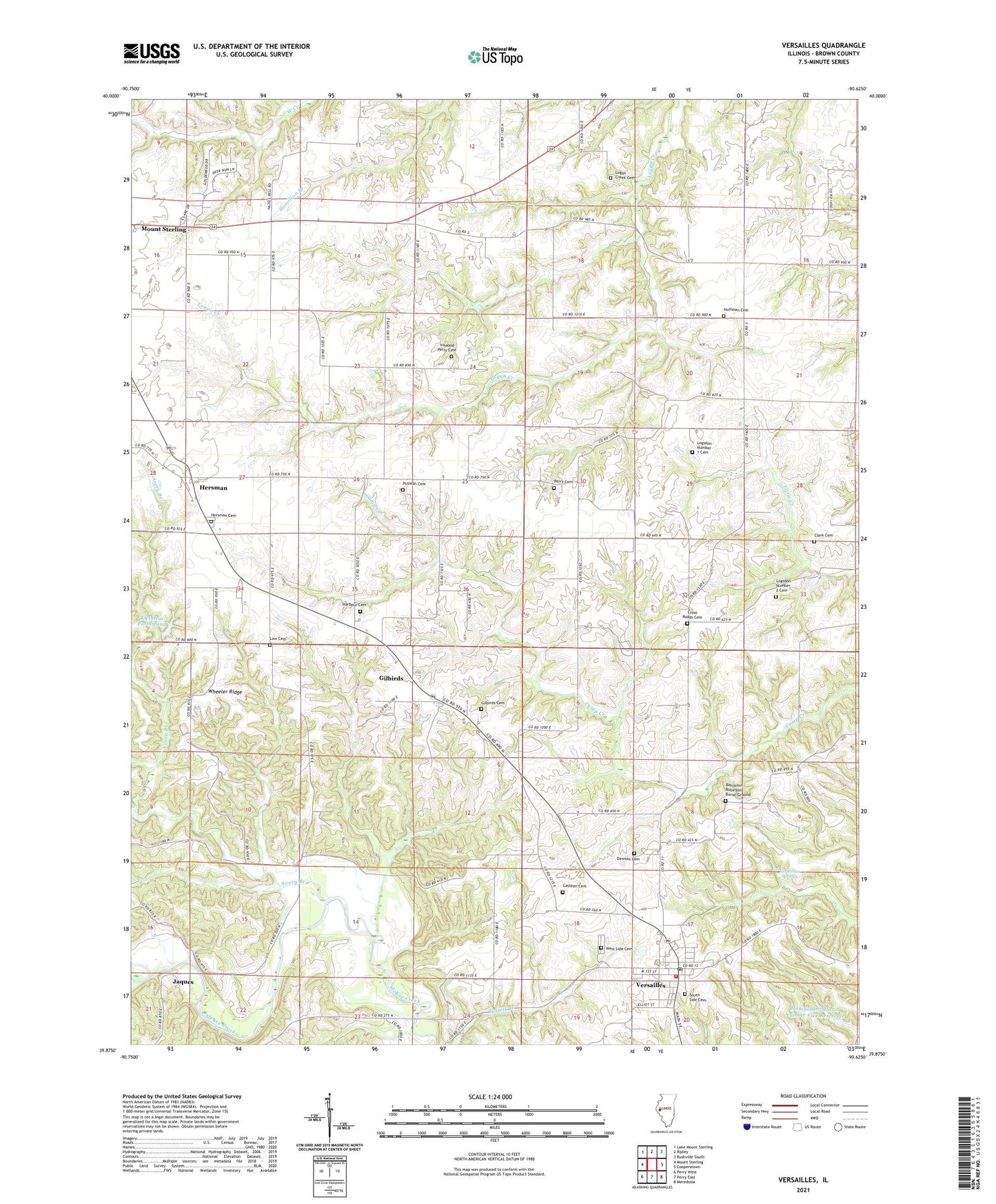
2024 topographic map quadrangle Versailles in the state of Illinois. Scale: 1:24000. Based on the newly updated USGS 7.5' US Topo map series, this map is in the following counties: Brown. The map contains contour data, water features, and other items you are used to seeing on USGS maps, but also has updated roads and other features. This is the next generation of topographic maps. Printed on high-quality waterproof paper with UV fade-resistant inks.
Quads adjacent to this one:
West: Mount Sterling
Northwest: Lake Mount Sterling
North: Ripley
Northeast: Rushville South
East: Cooperstown
Southeast: Meredosia
South: Perry East
Southwest: Perry West
This map covers the same area as the classic USGS quad with code o39090h6.
Contains the following named places: Avery Branch, Barton School, Benjamin Robinson Burial Ground, Casteen Cemetery, Clark Cemetery, Cross Roads Cemetery, Crossroads School, Dawson Cemetery, Gilbirds, Gilbirds Cemetery, Hambaugh-Martin Number Five Reservoir, Hambaugh-Martin Structure Number 5 Dam, Harbour Cemetery, Harper School, Hazel Bell School, Hersman, Hersman Cemetery, Hill School, Howe School, Huffman Cemetery, Ichabod Perry Cemetery, Jaques, Kleinlein Farm Pond, Kleinlein Farm Pond Dam, Law Cemetery, Logan Creek Cemetery, Logsdon Number 1 Cemetery, Logsdon Number 2 Cemetery, McDaniel School, Mount Pleasant Church, North Bend School, Patterson School, Perry Cemetery, Perry School, Pleasant Hill School, Putman Cemetery, Robison School, South Side Cemetery, Township of Elkhorn, Township of Mount Sterling, Versailles, Versailles Fire Protection District, Versailles Grade School, Versailles Post Office, Versailles Springs, Village of Versailles, West Side Cemetery, Wheeler Ridge, ZIP Code: 62378