MyTopo
Perry East Illinois US Topo Map
Couldn't load pickup availability
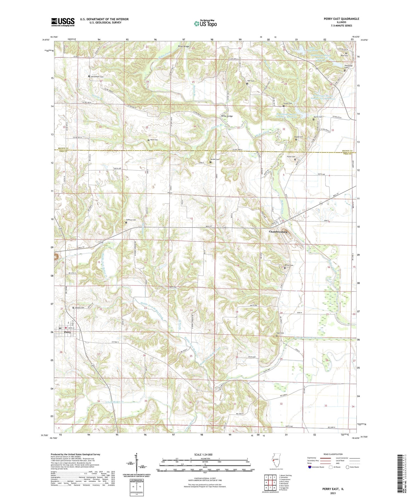
2024 topographic map quadrangle Perry East in the state of Illinois. Scale: 1:24000. Based on the newly updated USGS 7.5' US Topo map series, this map is in the following counties: Pike, Brown. The map contains contour data, water features, and other items you are used to seeing on USGS maps, but also has updated roads and other features. This is the next generation of topographic maps. Printed on high-quality waterproof paper with UV fade-resistant inks.
Quads adjacent to this one:
West: Perry West
Northwest: Mount Sterling
North: Versailles
Northeast: Cooperstown
East: Meredosia
Southeast: Florence
South: Griggsville
Southwest: New Salem
This map covers the same area as the classic USGS quad with code o39090g6.
Contains the following named places: Alsup Farm Pond, Alsup Farm Pond Dam, Brown Cemetery, Calhoun Cemetery, Chambersburg, De Frates-Shaeffer Lake, De Frates-Shaeffer Lake Dam, Dorsey Cemetery, Grout School, Hall Cemetery, Hall School, Ham Cemetery, Ham School, Hambaugh Cemetery, Hambaugh School, Hambaugh-Martin Number 1 Dam, Hambaugh-Martin Number 1 Reservoir, Hambaugh-Martin Number 3 Dam, Hambaugh-Martin Number 3 Reservoir, Hambaugh-Martin Number Two Reservoir, Hambaugh-Martin Structure Number 2 Dam, Hambaugh-Martin Structure Number 6 Dam, Hume Cemetery, Leineke Branch, Martin Branch, Martin Cemetery, Middle Fork McKee Creek, Newenham Cemetery, North Pike Fire Protection District, Perry, Perry Middle School, Perry Post Office, Perry Springs School, Perry Springs Station, Ritter Bridge, Root Cemetery, Rusk Cemetery, Russett Branch, Spring Branch, Summit School, Suratt Cemetery, Todd School, Township of Chambersburg, Township of Perry, Varder Bridge, Varder Cemetery, Village of Perry, Washington School, Woods Cemetery, ZIP Codes: 62323, 62362