MyTopo
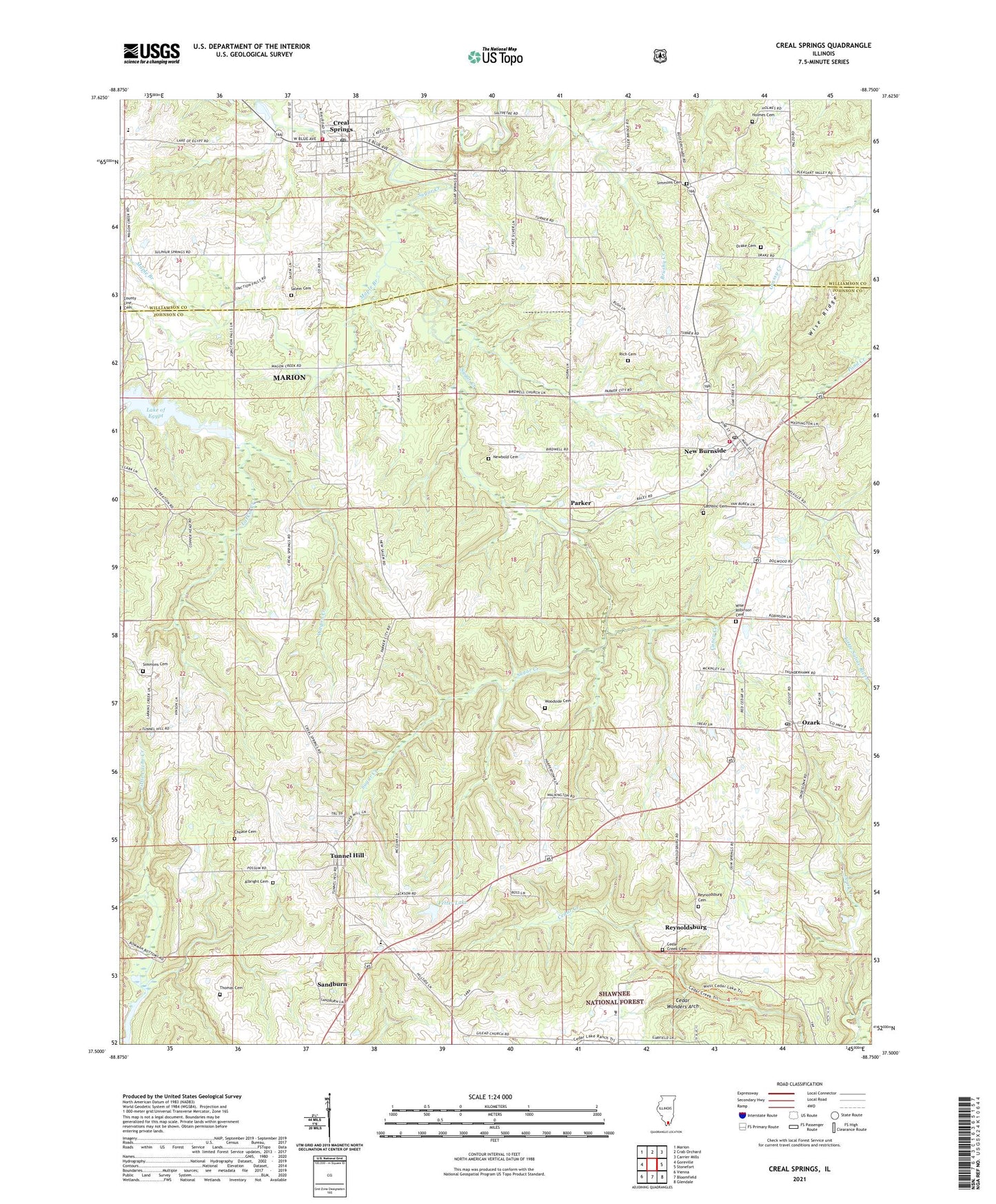
Creal Springs Illinois US Topo Map
Couldn't load pickup availability
Also explore the Creal Springs Forest Service Topo of this same quad for updated USFS data
2024 topographic map quadrangle Creal Springs in the state of Illinois. Scale: 1:24000. Based on the newly updated USGS 7.5' US Topo map series, this map is in the following counties: Johnson, Williamson. The map contains contour data, water features, and other items you are used to seeing on USGS maps, but also has updated roads and other features. This is the next generation of topographic maps. Printed on high-quality waterproof paper with UV fade-resistant inks.
Quads adjacent to this one:
West: Goreville
Northwest: Marion
North: Crab Orchard
Northeast: Carrier Mills
East: Stonefort
Southeast: Glendale
South: Bloomfield
Southwest: Vienna
This map covers the same area as the classic USGS quad with code o37088e7.
Contains the following named places: Albright Cemetery, Bidwell School, Burnside Election Precinct, Caney Creek, Catholic Cemetery, Cedar Creek Cemetery, Cedar Lake Dam, Cedar Wonders Arch, Choate Cemetery, City of Creal Springs, County Line Cemetery, County Line Church, Creal Springs, Creal Springs Elementary School, Creal Springs Post Office, Drake Cemetery, Fetter Lake, Fetter Lake Dam, Finley Chapel, Free Silver School, Hailey School, Holmes Cemetery, Howerton School, Lake Echon, Lake Echon Dam, Lake Number 2 Election Precinct, Lake of Egypt Recreation Area, Lake Thunderhawk, Lake Thunderhawk Dam, Larkin Creek, Maple Branch, Mount Moriah Church, New Burnside, New Burnside Center, New Burnside Fire Protection District, New Burnside Post Office, New Salem Church, Newbold Cemetery, Oak Grove School, Ondessonk Camp, Ozark, Ozark Creek, Ozark Election Precinct, Ozark Post Office, Parker, Reynoldsburg, Reynoldsburg Post Office, Rich Cemetery, Salem Cemetery, Sandburn, Shawnee National Forest, Simmons Cemetery, Sullins School, Sulphur Springs, Thomas Cemetery, Township of Burnside, Tunnel Hill, Tunnel Hill Center, Tunnel Hill Post Office, Village of New Burnside, Wagon Creek, Williamson County Fire Protection District Station 7, Wise Ridge, Wise Robinson Cemetery, Wittenburg School, Woodside Cemetery, WOOZ-FM (Harrisburg), WSIL-TV (Harrisburg), ZIP Codes: 62922, 62972