MyTopo
Carrier Mills Illinois US Topo Map
Couldn't load pickup availability
Also explore the Carrier Mills Forest Service Topo of this same quad for updated USFS data
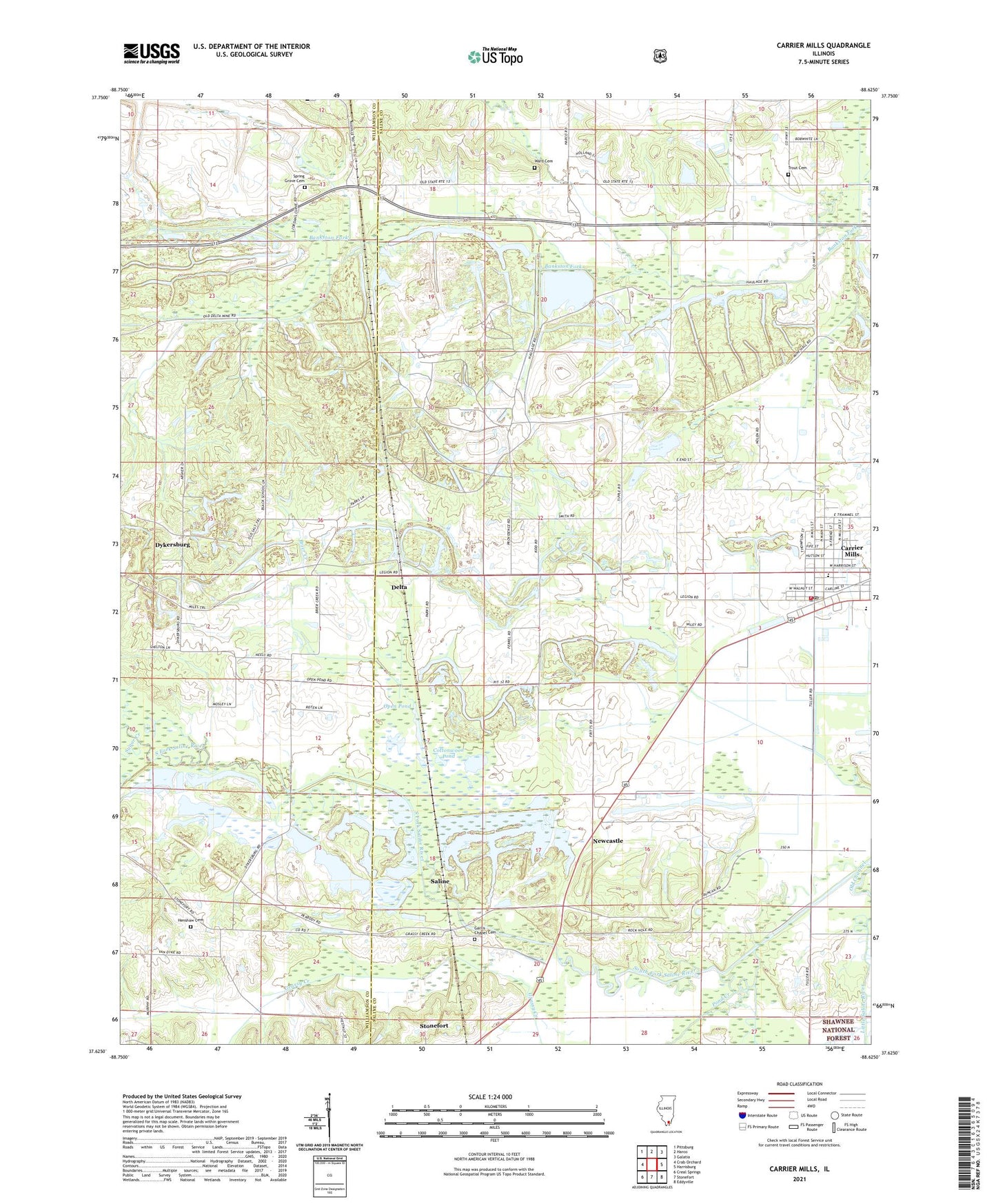
2024 topographic map quadrangle Carrier Mills in the state of Illinois. Scale: 1:24000. Based on the newly updated USGS 7.5' US Topo map series, this map is in the following counties: Saline, Williamson. The map contains contour data, water features, and other items you are used to seeing on USGS maps, but also has updated roads and other features. This is the next generation of topographic maps. Printed on high-quality waterproof paper with UV fade-resistant inks.
Quads adjacent to this one:
West: Crab Orchard
Northwest: Pittsburg
North: Harco
Northeast: Galatia
East: Harrisburg
Southeast: Eddyville
South: Stonefort
Southwest: Creal Springs
This map covers the same area as the classic USGS quad with code o37088f6.
Contains the following named places: Black School, Black Slough, Blue Bird Mine Number 7, Brier Creek, Bunker Hill School, Carmac Mine, Carrier Mills, Carrier Mills Elementary School, Carrier Mills Fire Department, Carrier Mills High School, Carrier Mills Park, Carrier Mills Police Department, Carrier Mills Post Office, Cottonwood Pond, Dallasania Church, Delta, Dykersburg, Dykersburg School, Garris Chapel Cemetery, Harris School, Henshaw Cemetery, Henshaw School, Holmes School, Indian Camp Church, Mayhew School, Moores Grove Park, Newcastle, Newcastle School, Open Pond, Peabody-Will Scarlet Heliport, Pond Creek, Providence Church, Rock Creek, Sahara Mine Number 5, Sahara Mine Number 7, Saline, Shelton School, South America Church, Spring Grove Cemetery, Spring Grove Church, Sugar Creek, Township of Carrier Mills, Trout Cemetery, Village of Carrier Mills, Ward Cemetery, Wasson Mine Number 2, ZIP Code: 62917