MyTopo
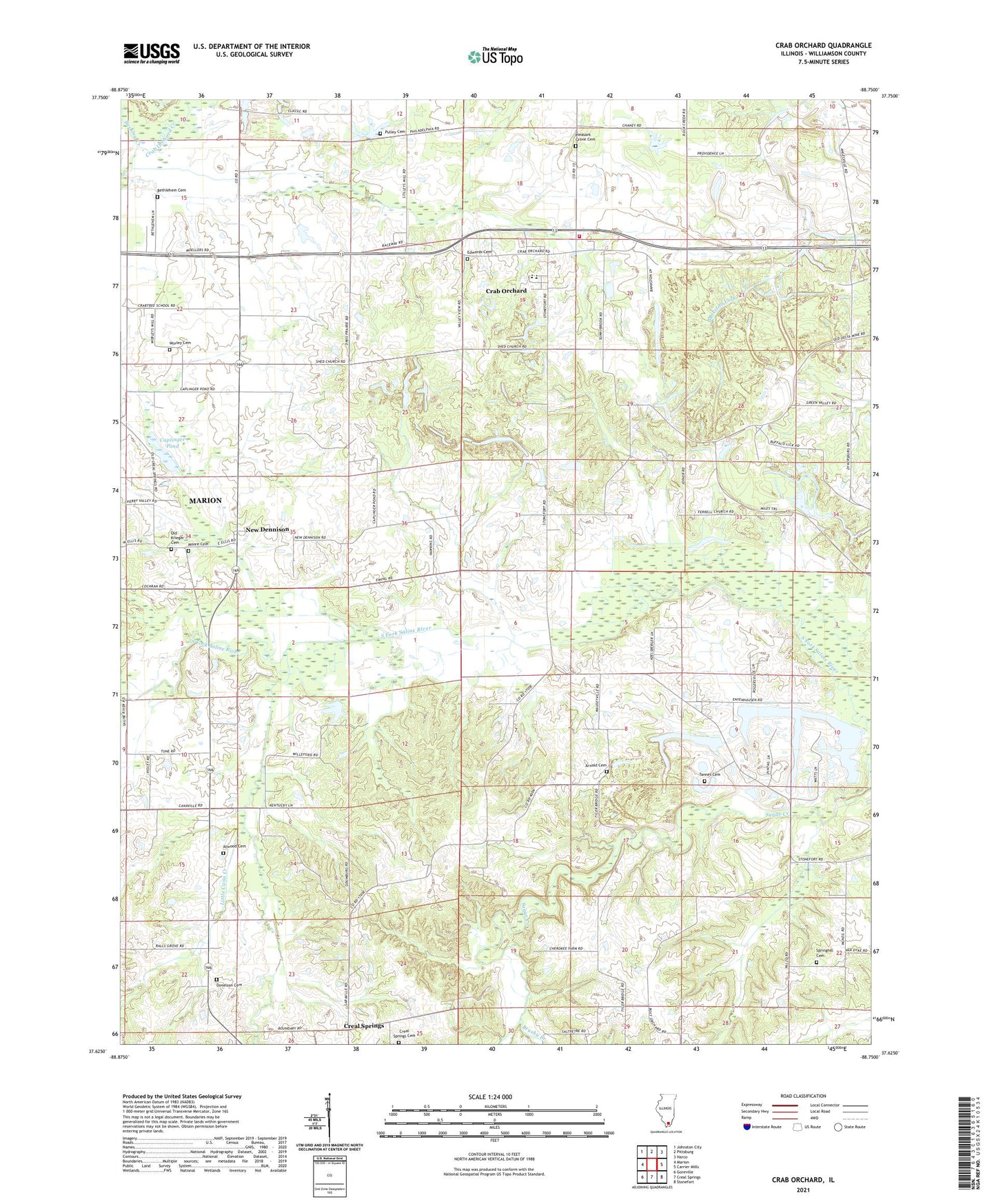
Crab Orchard Illinois US Topo Map
Couldn't load pickup availability
Also explore the Crab Orchard Forest Service Topo of this same quad for updated USFS data
2024 topographic map quadrangle Crab Orchard in the state of Illinois. Scale: 1:24000. Based on the newly updated USGS 7.5' US Topo map series, this map is in the following counties: Williamson. The map contains contour data, water features, and other items you are used to seeing on USGS maps, but also has updated roads and other features. This is the next generation of topographic maps. Printed on high-quality waterproof paper with UV fade-resistant inks.
Quads adjacent to this one:
West: Marion
Northwest: Johnston City
North: Pittsburg
Northeast: Harco
East: Carrier Mills
Southeast: Stonefort
South: Creal Springs
Southwest: Goreville
This map covers the same area as the classic USGS quad with code o37088f7.
Contains the following named places: Arnold Cemetery, Arnold School, Arnold View Church, Atwood Cemetery, Barbara Kay Mine, Bethlehem Cemetery, Brushy Creek, Buckley Creek, Cana Church, Cana Creek, Caplinger Pond, Central School, Cherry Valley School, Coal Bank Springs Church, Corley School, Crab Orchard, Crab Orchard Census Designated Place, Crab Orchard Election Precinct, Crab Orchard High School, Crabtree School, Creal Springs Cemetery, Creal Springs Election Precinct, Davis Prairie Church, Delta Mine, Donelson Cemetery, Donelson School, East Marion Election Precinct, Edwards Cemetery, Fairview Church, Ferrell Church, Little Cana Creek, Little Crab Orchard Creek, Moore Cemetery, Motsinger School, Mount Pleasant Church, New Dennison, Odumburg School, Old Krieger Cemetery, Palzo, Parks Cemetery, Parks School, Pleasant Grove Cemetery, Pulley Cemetery, Rodgersville, Springhill Cemetery, Springhill Church, Stonefort Election Precinct, Tanner Cemetery, Walnut Hill Church, Willeford, Williamson County Fire Protection District Station 3, Wilson School, Worley Cemetery, Wright School