MyTopo
Snyder Illinois US Topo Map
Couldn't load pickup availability
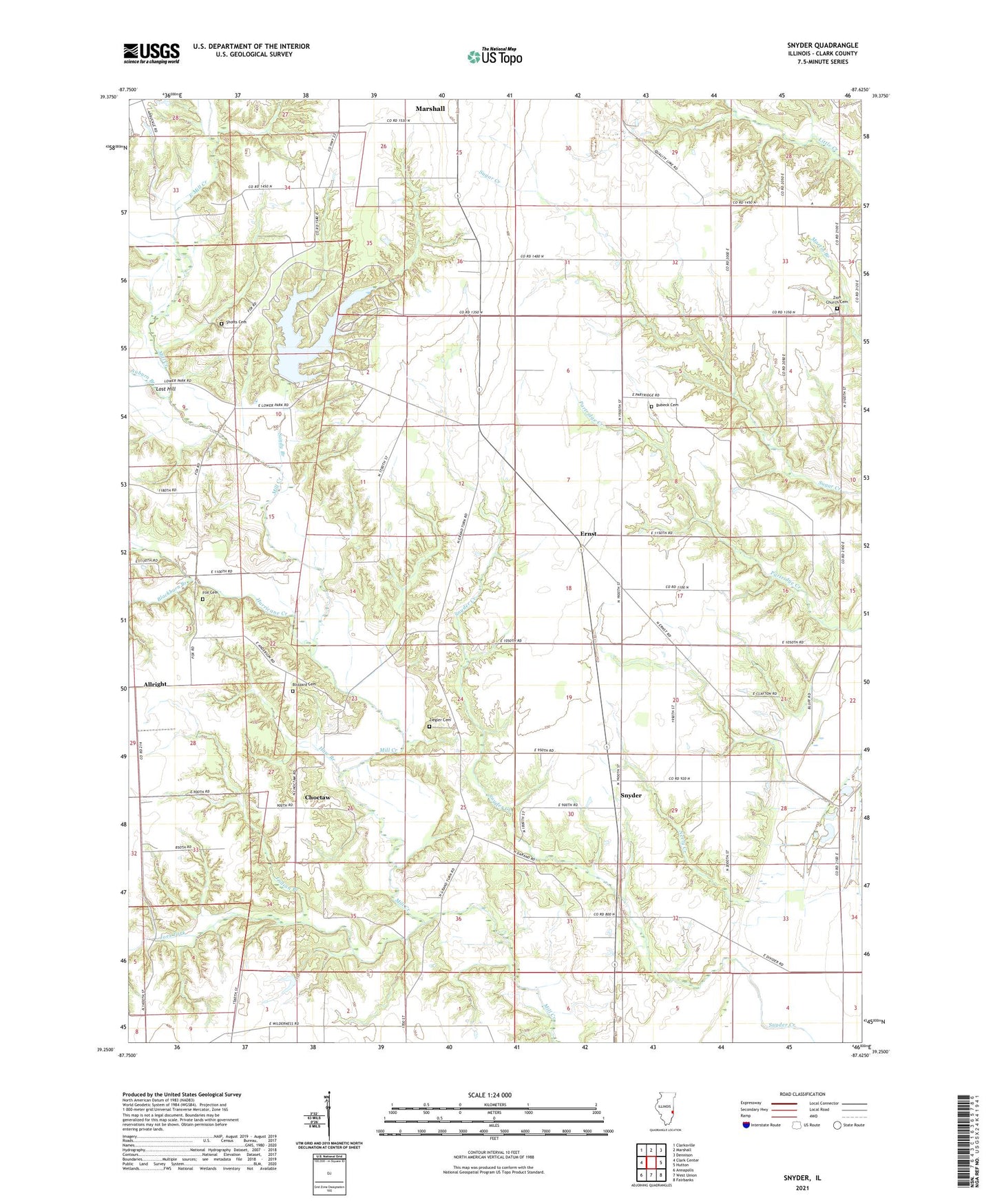
2024 topographic map quadrangle Snyder in the state of Illinois. Scale: 1:24000. Based on the newly updated USGS 7.5' US Topo map series, this map is in the following counties: Clark. The map contains contour data, water features, and other items you are used to seeing on USGS maps, but also has updated roads and other features. This is the next generation of topographic maps. Printed on high-quality waterproof paper with UV fade-resistant inks.
Quads adjacent to this one:
West: Clark Center
Northwest: Clarksville
North: Marshall
Northeast: Dennison
East: Hutton
Southeast: Fairbanks
South: West Union
Southwest: Annapolis
This map covers the same area as the classic USGS quad with code o39087c6.
Contains the following named places: Allright, American Beech Woods Nature Preserve, Anderson Townhall, Auburn Branch, Avon School, Baggs School, Blackburn Branch, Blackhawk School, Blizzard Cemetery, Bubeck Cemetery, Choctaw, Choctaw School, Cole School, Craig Chapel, East Mill Creek, Eckels School, Emmanuel United Methodist Church, Ernst, Fox Cemetery, Grand Turn, Haw Branch, Hurricane Creek, Indian Branch, Joes Fork, Kile School, Lakeside Campground, Lincoln Trail State Park, Lincoln Trail State Park Lake, Lincoln Trail State Park Lake Dam, Lost Hill, Maple Grove Picnic Area, Oak Ridge Picnic Area, Ohio School, Plainview Campground, Red Oak Picnic Area, Sandy Branch, Sassafras Picnic Area, Sherman School, Shotts Cemetery, Siverly School, Snyder, Stump School, Sweet Gum Lane Picnic Area, Township of Anderson, Township of Darwin, Washington School, White Oak Picnic Area, Ziegler Cemetery, Zion Church Cemetery, Zion United Methodist Church