MyTopo
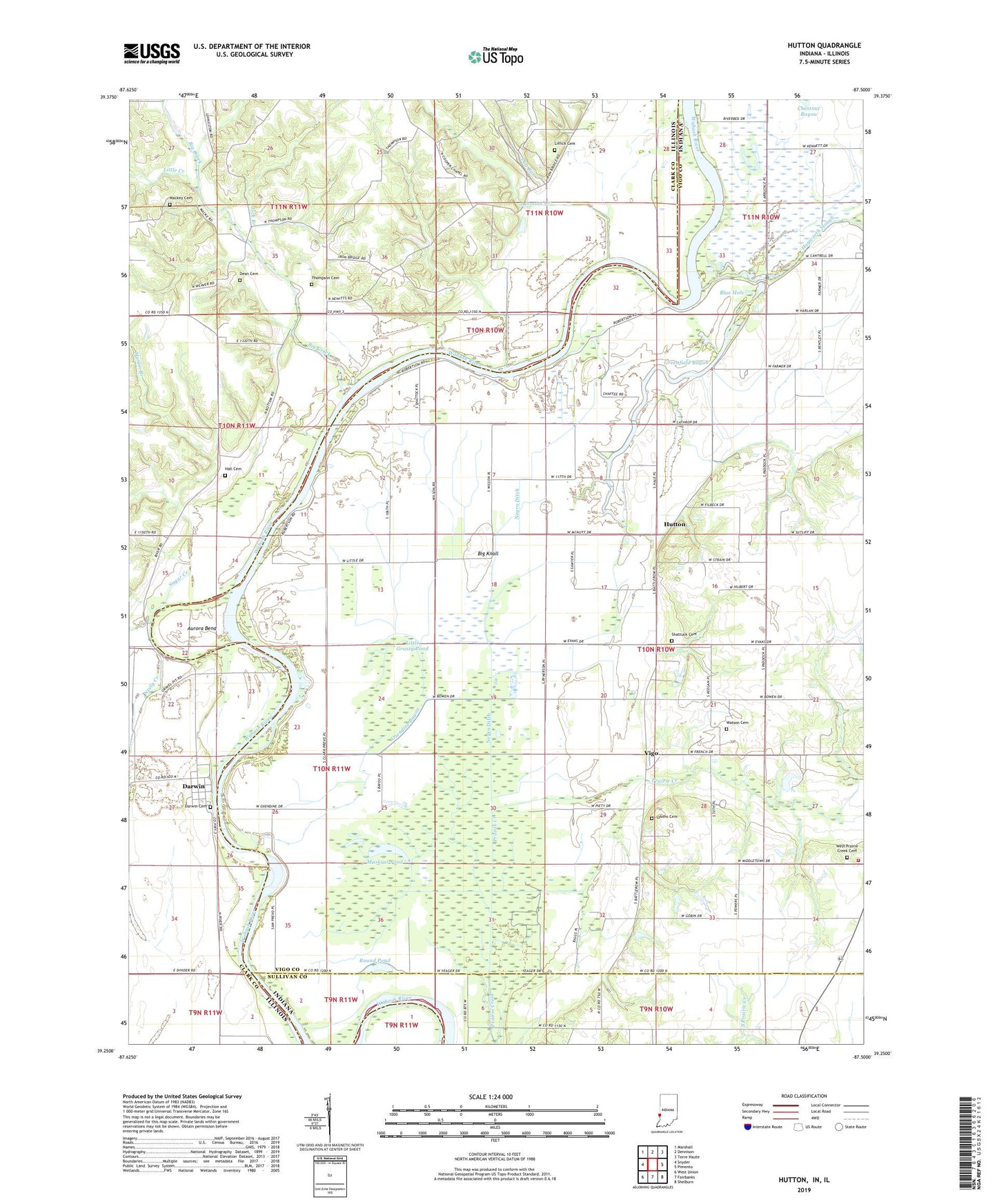
Hutton Indiana US Topo Map
Couldn't load pickup availability
2022 topographic map quadrangle Hutton in the states of Indiana, Illinois. Scale: 1:24000. Based on the newly updated USGS 7.5' US Topo map series, this map is in the following counties: Vigo, Clark, Sullivan. The map contains contour data, water features, and other items you are used to seeing on USGS maps, but also has updated roads and other features. This is the next generation of topographic maps. Printed on high-quality waterproof paper with UV fade-resistant inks.
Quads adjacent to this one:
West: Snyder
Northwest: Marshall
North: Dennison
Northeast: Terre Haute
East: Pimento
Southeast: Shelburn
South: Fairbanks
Southwest: West Union
This map covers the same area as the classic USGS quad with code o39087c5.
Contains the following named places: Ashmore Creek, Aurora Bend, Big Creek, Big Knoll, Blue Hole, Bohn Ferry, Center Hill Church, Cooper Chapel, Darwin, Darwin Cemetery, Darwin Ferry, Dean Cemetery, Dog Run, Grassy Pond, Greenfield Bayou, Hall Cemetery, Hall School, Hayworth Slough, Higginbotham Field, Hutton, Liberty Square School, Lick Branch, Liffick Cemetery, Little Creek, Little Grassy Pond, Lykens Cemetery, Macke Cemetery, Martin Branch, Muskrat Pond, Neely Creek, Negro Ditch, Oxendine Bayou, Partridge Creek, Prairie Creek Township Fire Department, Round Pond, Shattuck Cemetery, South Prairie Creek, Stone Pond, Sugar Creek, Taylor Ford, Thompson Cemetery, Township of Prairie Creek, Vigo, Waters Ford, Watson Cemetery, West Prairie Creek Cemetery