MyTopo
Donovan Illinois US Topo Map
Couldn't load pickup availability
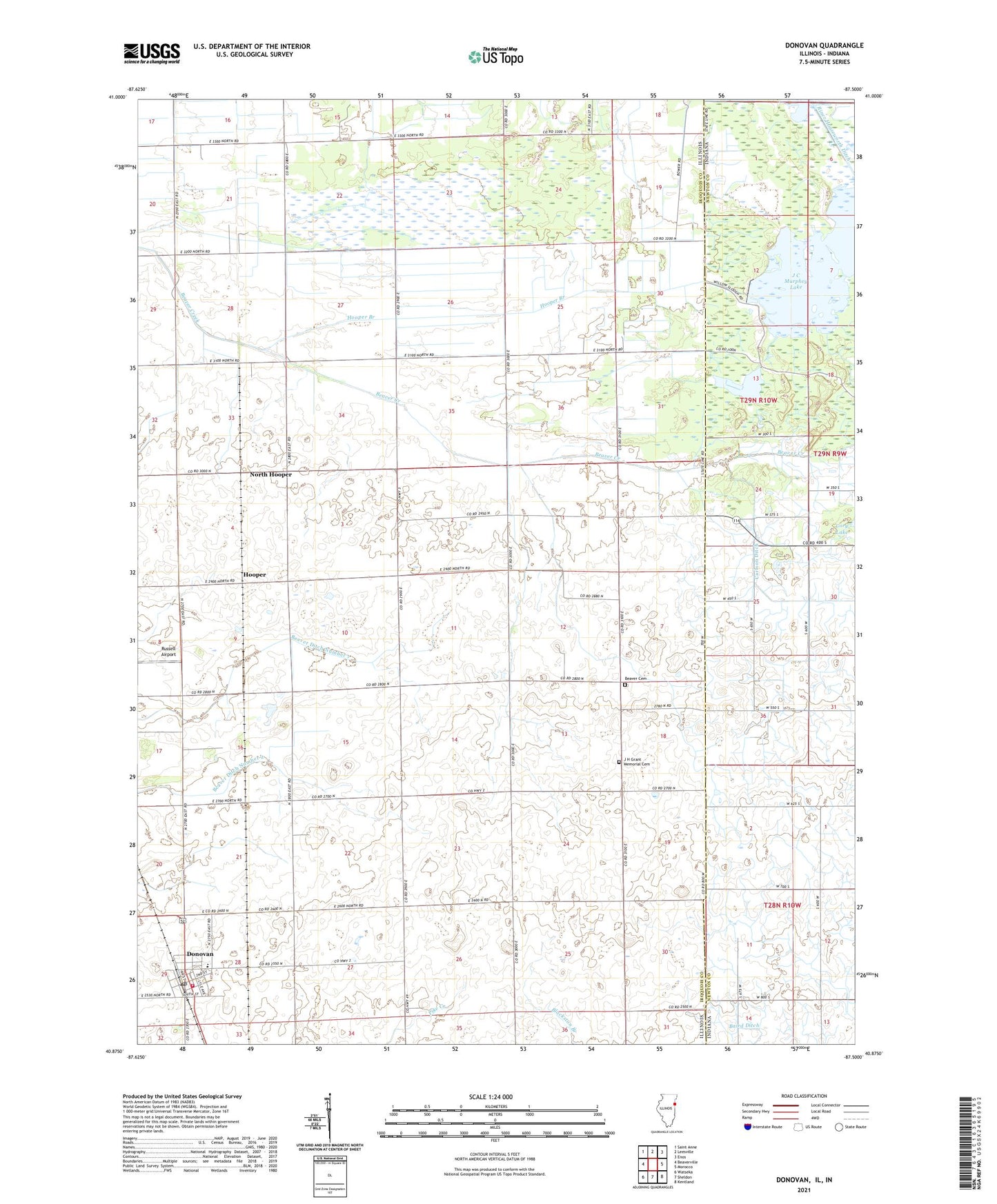
2024 topographic map quadrangle Donovan in the states of Illinois, Indiana. Scale: 1:24000. Based on the newly updated USGS 7.5' US Topo map series, this map is in the following counties: Iroquois, Newton. The map contains contour data, water features, and other items you are used to seeing on USGS maps, but also has updated roads and other features. This is the next generation of topographic maps. Printed on high-quality waterproof paper with UV fade-resistant inks.
Quads adjacent to this one:
West: Beaverville
Northwest: Saint Anne
North: Leesville
Northeast: Enos
East: Morocco
Southeast: Kentland
South: Sheldon
Southwest: Watseka
Contains the following named places: Beaver Cemetery, Beaver Church, Beaver Ditch Number 1, Beaver Ditch Number 2, Beaver Fire Protection District, College Corner School, Donovan, Donovan Junior High School, Donovan Post Office, Donovan Senior High School, Fairview School, Frigon School, Hooper, Hooper Branch, Independence School, Iroquois County State Conservation Area, J C Murphey Lake, J C Murphy Lake Dam, J H Grant Memorial Cemetery, Loy Airport, Maple Grove School, North Hooper, Pleasant Valley School, Russell Airport, Salem School, Township of Beaver, Township of Beaverville, Village of Donovan, West Grove School, ZIP Codes: 60912, 60931