MyTopo
Saint Anne Illinois US Topo Map
Couldn't load pickup availability
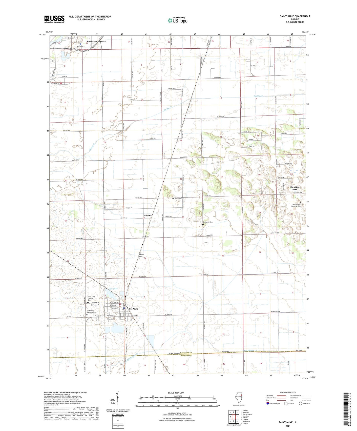
2024 topographic map quadrangle Saint Anne in the state of Illinois. Scale: 1:24000. Based on the newly updated USGS 7.5' US Topo map series, this map is in the following counties: Kankakee, Iroquois. The map contains contour data, water features, and other items you are used to seeing on USGS maps, but also has updated roads and other features. This is the next generation of topographic maps. Printed on high-quality waterproof paper with UV fade-resistant inks.
Quads adjacent to this one:
West: Kankakee
Northwest: Bradley
North: Momence
Northeast: Illiana Heights
East: Leesville
Southeast: Donovan
South: Beaverville
This map covers the same area as the classic USGS quad with code o41087a6.
Contains the following named places: Aroma Township Fire Protection District Station 2, Bible Camp, Collins, Concordia Cemetery, Cote Lake, Doney, Frogtown School, Giasson School, Guiding Star Church, Guiding Star Memorial Cemetery, Hanen School, Hopkins Park, Koster, Koster School, Leesville, Little Tabernacle Church, Mathers School, Oak Springs Golf Course, Oakwood Cemetery, Old Baptist Cemetery, Pembroke Church, Pembroke School, Rehoboth Church, Saint Anne, Saint Anne Catholic Cemetery, Saint Anne Community High School, Saint Anne Elementary School, Saint Anne Fire Protection District, Saint Anne Police Department, Saint Anne Post Office, Saint Anne Township Cemetery, Saint Anne Woods, Smamrock Golf Club, Sun River Terrace Village Police Department, Tallmadge, Township of Saint Anne, Union Church, Village of Saint Anne, Wichert, Wichert Church, Wiltse School, Wingerter School, ZIP Code: 60964