MyTopo
Leesville Illinois US Topo Map
Couldn't load pickup availability
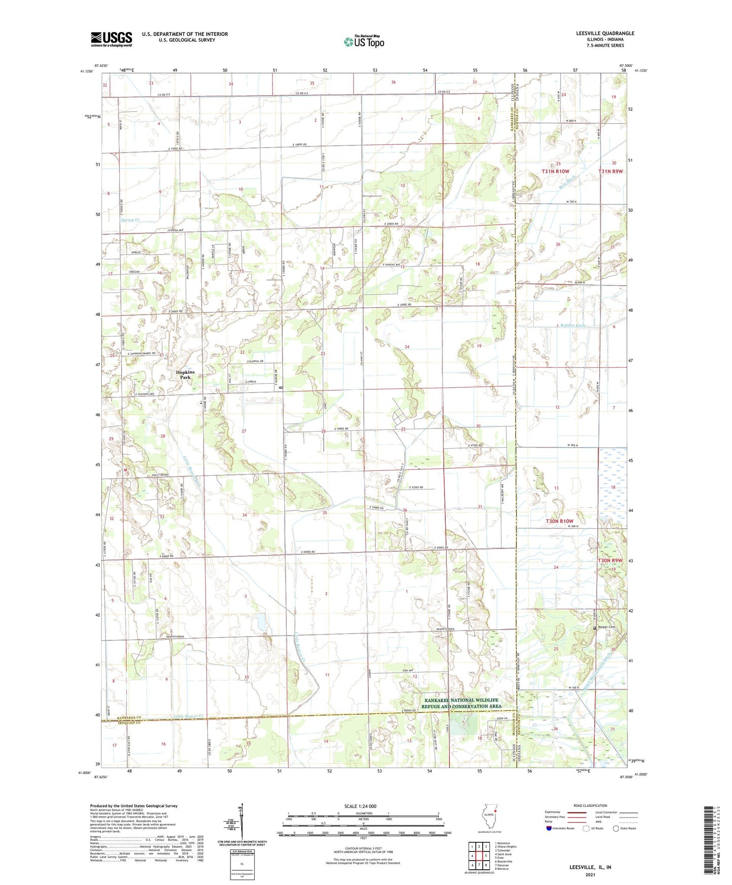
2024 topographic map quadrangle Leesville in the states of Illinois, Indiana. Scale: 1:24000. Based on the newly updated USGS 7.5' US Topo map series, this map is in the following counties: Kankakee, Newton, Iroquois. The map contains contour data, water features, and other items you are used to seeing on USGS maps, but also has updated roads and other features. This is the next generation of topographic maps. Printed on high-quality waterproof paper with UV fade-resistant inks.
Quads adjacent to this one:
West: Saint Anne
Northwest: Momence
North: Illiana Heights
Northeast: Schneider
East: Enos
Southeast: Morocco
South: Donovan
Southwest: Beaverville
Contains the following named places: Eyler School, Hooper Branch Savanna Nature Preserve, Hopkins Park Post Office, Johnson Ditch, Kankakee National Wildlife Refuge and Conservation Area, Morgan Cemetery, North Hopkins School, Pembroke, Pembroke Township Fire Protection District, Redden Ditch, Riner Houseworth Ditch, Township of Pembroke, Village of Hopkins Park, Whittemore School, Willow Slough State Game Preserve, ZIP Code: 60958