MyTopo
Effingham North Illinois US Topo Map
Couldn't load pickup availability
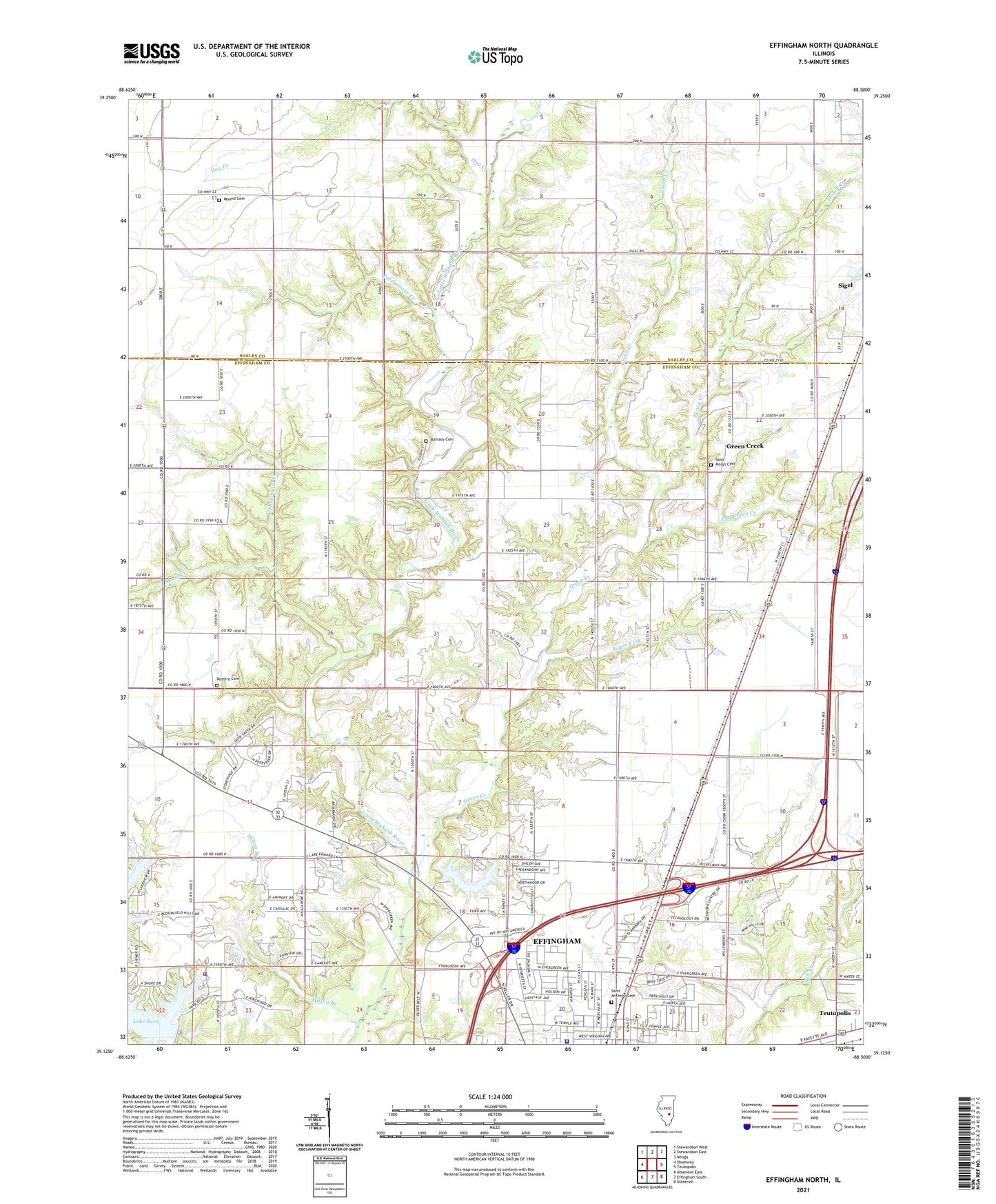
2024 topographic map quadrangle Effingham North in the state of Illinois. Scale: 1:24000. Based on the newly updated USGS 7.5' US Topo map series, this map is in the following counties: Effingham, Shelby. The map contains contour data, water features, and other items you are used to seeing on USGS maps, but also has updated roads and other features. This is the next generation of topographic maps. Printed on high-quality waterproof paper with UV fade-resistant inks.
Quads adjacent to this one:
West: Shumway
Northwest: Stewardson West
North: Stewardson East
Northeast: Neoga
East: Teutopolis
Southeast: Dieterich
South: Effingham South
Southwest: Altamont East
This map covers the same area as the classic USGS quad with code o39088b5.
Contains the following named places: Banner School, East Branch Green Creek, Ebenezer Church, Effingham Veterinary Clinic, Flat School, Green Creek, Green Creek Grade School, Greuel Dairy Farm, Henry Creek, Henry Farms, Hog Creek, Lake Pauline, Lake Sara Dam, Latch Farms, Milton Branch, Mound Cemetery, Mound School, North Fork Shoal Creek, North School, Pauline Lake Dam, Ramsey Cemetery, Ramsey Chapel, Rattlesnake Creek, Rentfro Cemetery, Saint Anthony Cemetery, Saint Anthony Grade School, Saint Anthony's Memorial Hospital, Saint Anthonys Roman Catholic Church, Saint Marys Cemetery, Shoal Creek, Shumway Fire Protection District, Sporleder Farms, Sugar Fork, Tebbe Farms, Township of Douglas, Township of Sigel