MyTopo
Wyoming Illinois US Topo Map
Couldn't load pickup availability
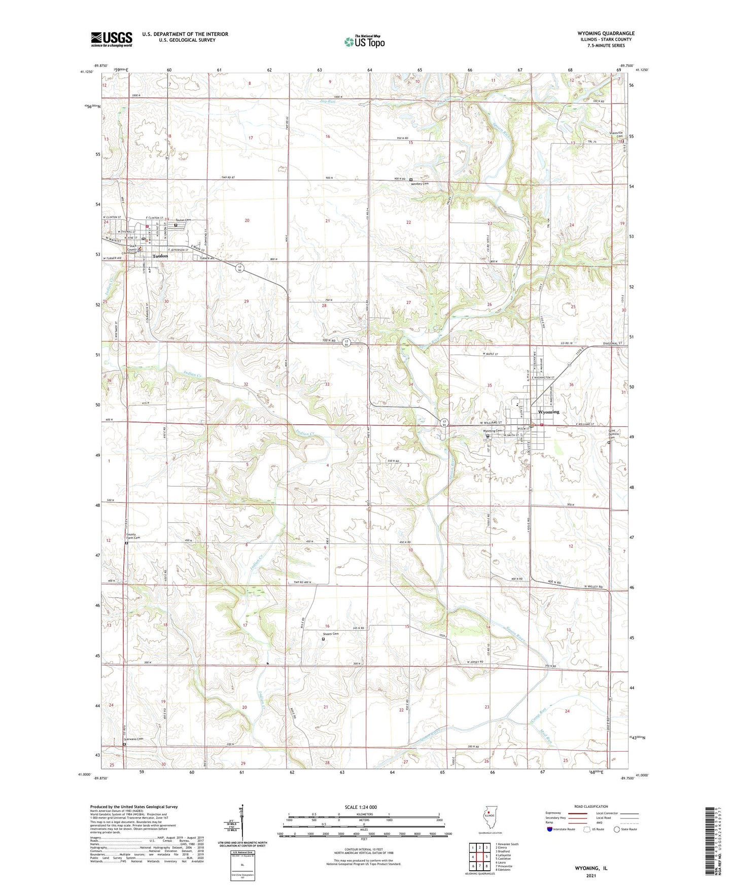
2024 topographic map quadrangle Wyoming in the state of Illinois. Scale: 1:24000. Based on the newly updated USGS 7.5' US Topo map series, this map is in the following counties: Stark. The map contains contour data, water features, and other items you are used to seeing on USGS maps, but also has updated roads and other features. This is the next generation of topographic maps. Printed on high-quality waterproof paper with UV fade-resistant inks.
Quads adjacent to this one:
West: Lafayette
Northwest: Kewanee South
North: Elmira
Northeast: Bradford
East: Castleton
Southeast: Edelstein
South: Princeville
Southwest: Laura
This map covers the same area as the classic USGS quad with code o41089a7.
Contains the following named places: Camp Run, City of Toulon, City of Wyoming, County Farm Cemetery, Cox School, Essex Grove School, Faith Baptist Church, First Baptist Church, First Congregational Church, First Congregational United Church of Christ, Hausmann Airport, Jug Run, Jug Run School, Locust Grove School, Mawbey Cemetery, Maxfield School, Mud Run, Ogle School, Pleasant Hill School, Saint Dominic Cemetery, Saint Dominic Church, Sheets Cemetery, Snareville Cemetery, Snareville School, Stark County, Stark County Ambulance Service, Stark County Ambulance Wyoming Station, Stark County Courthouse, Stark County High School, Stark County Jail, Stark County Junior High School, Stark County Sheriff's Office, Starwano Cemetery, Toulon, Toulon Cemetery, Toulon Fire Department, Toulon Post Office, Toulon Public Library, Toulon Public School, Toulon United Methodist Church, Toulon-Lafayette Grade School, Township of Essex, Township of Toulon, Webster Heliport, Winn School, Wyoming, Wyoming Airport, Wyoming Cemetery, Wyoming Community Fire Protection District, Wyoming First Baptist Church, Wyoming Grade School, Wyoming Methodist Church, Wyoming Post Office